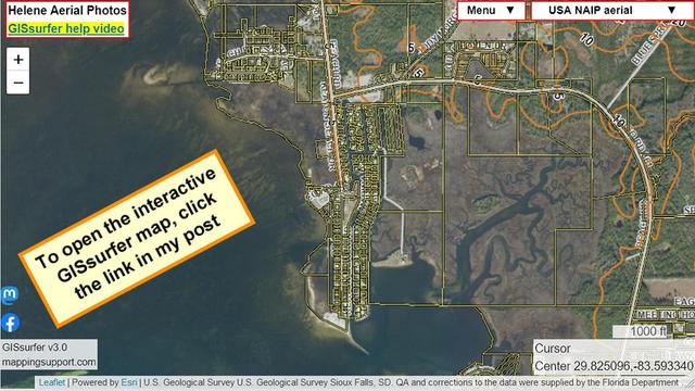
This map is centered on the Keaton Beach area of Florida where many homes are less than 5 feet above sea level! Sure hope everyone is gone from here.
The parcel layer (yellow lines) is ‘on top’ and can be clicked to see the attribute data including address.
As soon as it is safe NOAA will take aerial photos showing the damage. I will add those GIS layers to this map. There will be multiple overlays with flights covering different areas. The map will be able to display the street names and parcel lines on top of the aerial photos showing damage. To search on an address, click Menu > Search.
#Helene #HurricaneHelene #Hurricane #FLwx #Cat3