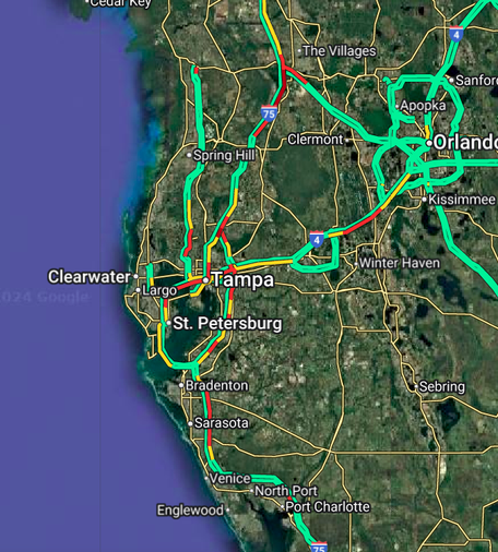
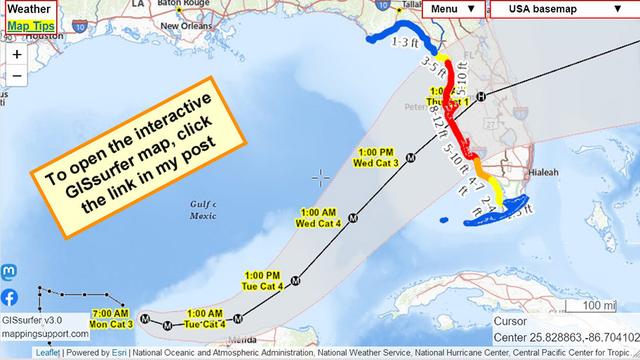
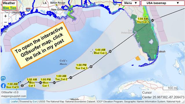
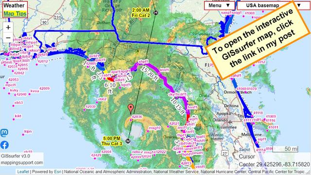
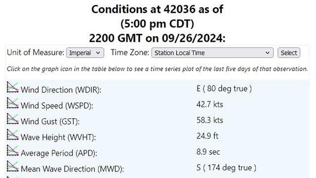
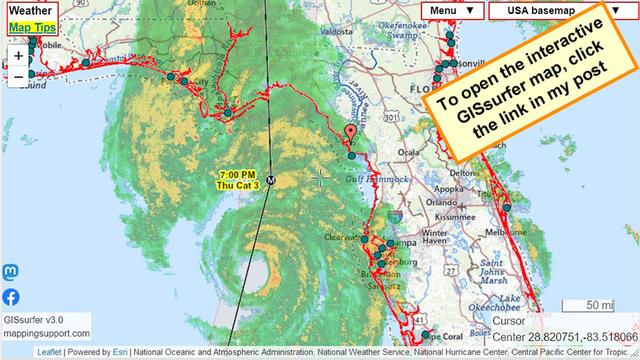
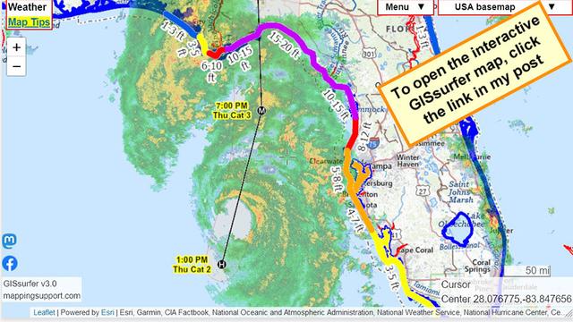
UPDATE!
this video of metereologist John Morales of #Florida's NBC6 is making the rounds so if you have not seen it, please give it a watch.
#Milton is now a #Cat5 hurricane but is expected to be #Cat3 by the time it hits the Florida Wednesday/Thursday.
#HurricaneHelene was a #Cat3 when it hit a week ago.
to the people who cannot leave: vacuum pack your valuables & papers; throw them in a backpack. use suitcases for food, linens, clothes, your kids fave toys, and find a shelter. good luck.
LOOK CLOSELY AT THIS EVACUATION ROUTES MAP FOR #FLORIDA
my dad, who was an urban planner, would often rant about how Republicans were denying federal money to Puerto Rico to build up the swamps of Florida.
that whole Orlando area, what he called MickeyMouselandia, should have never happened. it's a swiss cheese of marshes, wetlands, swamps. Y'all had a #Cat3 with #Helene and now #Milton is #Cat5
#Florida is producing millions of #climateCrisis refugees
Attached: 1 image Florida traffic is already congested. As always, evacuate early, evacuate often (if you can, I understand the many issues possible with evacuations). #FLwx #evacuations #Milton
#HurricaneMilton is now at #Category3 strength. NOAA is currently forecasting it will increase in strength to #Category4 before dropping back to category 3 before landfall. Of course that could change.
#FLwx #Cat3 #Cat4
NOAA is forecasting that #Milton will remain at hurricane strength all the way across Florida.
Each time you open this map you will see the latest official forecast from the National Hurricane Center. #TSMilton #HurricaneMilton #FLwx #Cat3
One of the few bouys with data is #42036 just below the red marker on the map. If you open the map and click that marker then when the bouy webpage opens you can scroll down for a lot more info.
#Helene #HurricaneHelene #Hurricane #FLwx #Cat3
This map is centered on the Keaton Beach area of Florida where many homes are less than 5 feet above sea level! Sure hope everyone is gone from here.
The parcel layer (yellow lines) is ‘on top’ and can be clicked to see the attribute data including address.
As soon as it is safe NOAA will take aerial photos showing the damage. I will add those GIS layers to this map. There will be multiple overlays with flights covering different areas. The map will be able to display the street names and parcel lines on top of the aerial photos showing damage. To search on an address, click Menu > Search.
#Helene #HurricaneHelene #Hurricane #FLwx #Cat3
One of the GIS layers the map can display is called “Coastal gage”. That layer is the green dots on this map. Since that layer is ‘on top’ it can be clicked to display the attribute values.
If you click a gage and follow the first link in the popup then you can see a web page showing water level over time including any storm surge.
Then just above that graph, click the link “Meteorological Obs”. You then see a graph showing wind speed over time.
The screenshots are from the gage at Cedar Key which is just below the red marker.
#Helene #HurricaneHelene #Hurricane #FLwx #Cat3
Showing up good on radar now.
#Helene #HurricaneHelene #Hurricane #FLwx #Cat3
941
WTNT64 KNHC 261825
TCUAT4
Hurricane Helene Tropical Cyclone Update
NWS National Hurricane Center Miami FL AL092024
225 PM EDT Thu Sep 26 2024
...AIR FORCE HURRICANE HUNTERS FIND HELENE A MAJOR HURRICANE...
The Air Force Hurricane Hunters found that the maximum sustained winds have increased to near 120 mph (195 km/h). This makes Helene a dangerous category 3 major hurricane.
Additional strengthening is expected before Helene makes landfall in the Florida Big Bend this evening.
https://mesonet.agron.iastate.edu/wx/afos/p.php?pil=TCUAT4&e=202409261825