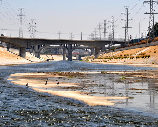
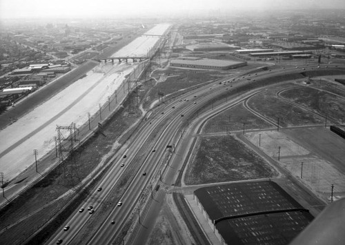
Unlike many #rivers that terminate in a #seaport, the #LARiver was never navigable by ship. It was more of a marshy estuarial system, fanning out all over #wetlands. The placement of the #LosAngeles/ #LongBeach #ports is actually kind of arbitrary as far as the river is concerned--but the river had to be managed to support #railroads & later, freeways.

Here you can see downtown LA thru haze (& electrical pylons). DTLA is ~20 miles north of where the river terminates in San Pedro Bay

Why did regional officials confine the LA River in cement & destroy acres of #wetlands? One reason was to make dry land to support freight movement. LAR empties into San Pedro Bay, home to the western hemisphere's largest container #shipping #port complex.
Glimpse of a tiny fraction of the rail running from the ports to distribution near DTLA. Land is river's floodplain, made dry.

The #ports were sited in San Pedro Bay before #oil was "discovered" locally, but the wealth that oil extraction & trade generated allowed capitalists to (literally) cement San Pedro Bay as an important node in global #trade, pouring oil profits into building up the ports.

I'd argue you can see both refinery & exhaust outputs in the red glow of the moonrise here.

View is from Port of LA looking east #LosAngeles

If you're in North America, even if you don't live anywhere near #LosAngeles, you're probably participating in some way in this infrastructural system. You likely have consumer goods in your house, maybe within arm's reach, that came in through these ports and traveled by highway to you. This is freeway getting built, 1961, via LA Public Library

@inquiline It's hard to communicate just how central freeways are in defining LA (and urban SoCal generally). I've lived all over the US and was blown away how directions and sense of place was completely oriented to these built infrastructure.

Reframing this as national infrastructure rather then local transport makes a lot of sense here. Thank you!