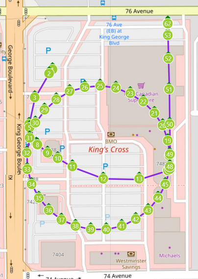
I added a feature to my Mini 4 Pro waypoint editor that can display the actual path the drone flew using the SRT file it generates as subtitles for the flight.
Here's the path for the whole flight from which that last video is edited. Each marker is 5s of flight.