We are so connected.
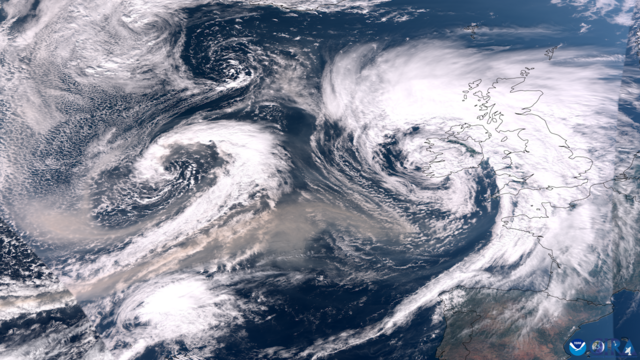
This satellite image from the VIIRS instrument onboard NOAA’s JPSS satellites shows Canadian wildfire smoke being pulled across the Atlantic Ocean by two areas of low pressure on September 27, 2023.
https://www.nesdis.noaa.gov/news/todays-satellite-image-smoke-trails-behind-agnes
#climatechange #stormagnes
#wildfires #canada #uk