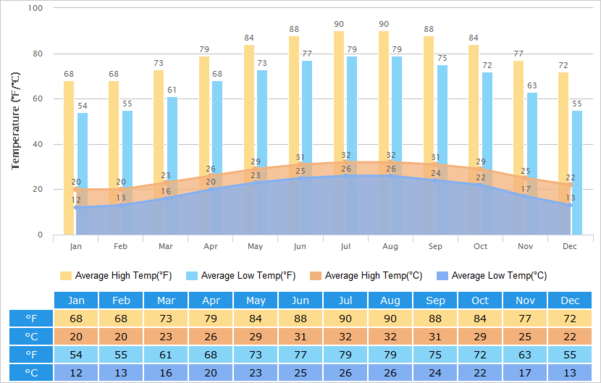
Great map for people who keep asking me "aren't you cold?"😁
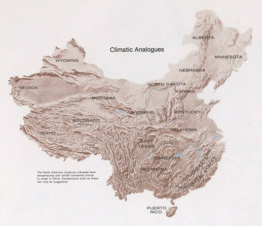
Starting a new semester means introducing students to China's geography. This is one of my favorite maps to use, showing that many places in China are similar to areas that students are likely familiar with! Source (to the best of my knowledge) from a 1971 CIA map

James Gethyn Evans on Twitter
“Starting a new semester means introducing students to China's geography. This is one of my favorite maps to use, showing that many places in China are similar to areas that students are likely familiar with! Source (to the best of my knowledge) from a 1971 CIA map”