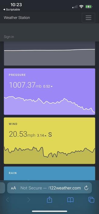
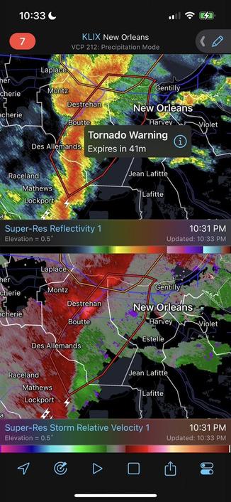
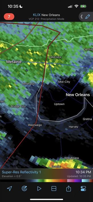
Looking at the relative velocity radar at least northern Orleans looks maybe a better bet for just a lotta wind and rain but less of a chance of circulation for a tornado, might even end up being most of the parish.
“Storms entering metro NOLA look more like wind producers than tornadic. Probably have some good wind gusts 60-70 mph incoming. It can do the same type of damage as a weak tornado so don’t let your guard down. #lawx”