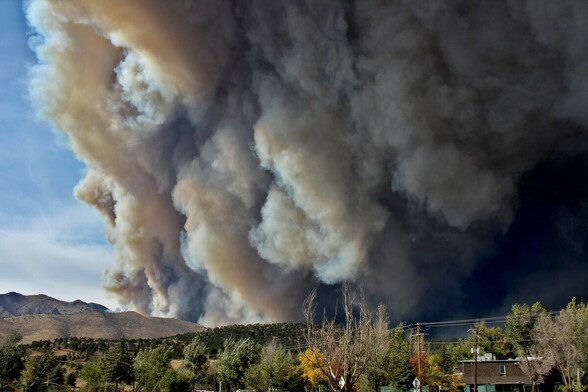
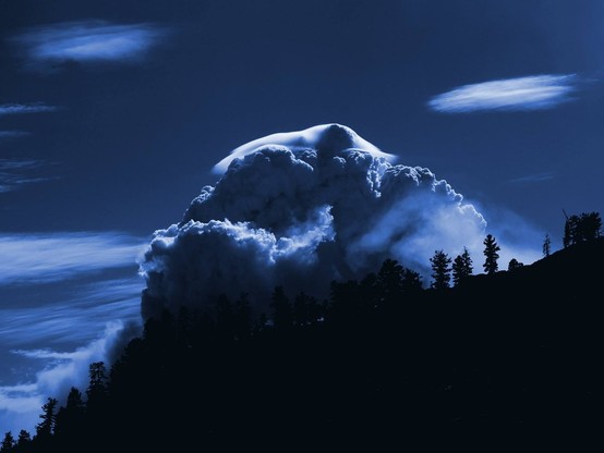
Thread: photographs of various clouds I've taken over the years. [1/n]

Pyrocumulonimbus (with pileus) atop Dark Horse Fire, Yosemite National Park. July 2016.

Shelf cloud on forward-advancing flank of thunderstorm near Esparto, CA. April 2014. [2/n]
View from between broken stratocumulus deck backlit by setting sun and high-level cirrus layer while descending into Vancouver, Canada. January 2015. [3/n]
Isolated monsoonal thunderstorm near Rachel, Nevada. Photo taken from State Route 375--also known as the "Extraterrestrial Highway." July 2016.
Rotating pyrocumulus plume and incipient fire vortex generated by Calwood Fire. View looking west/northwest from Altona, Colorado. October 2020. [5/n]
Unbroken marine stratus layer over the Pacific Ocean just west of San Francisco, California (view from ~10,000 feet). October 2017. [6/n]
"Ground crawling" shelf cloud on leading edge of supercell thunderstorm producing giant hail near Wiggins, CO. August 2021. [7/n]
Sunset featuring fiery monsoonal altocumulus from Stanford University campus. August 2014. [8/n]
Mountain wave cloud parallel to the Front Range from Boulder, Colorado. April 2019. [9/n]
View of springtime convective clouds (cumulus congestus) from lower stratosphere (~50,000 ft altitude) via weather balloon-lofted digital camera. View is looking eastward from above Paradise, CA. Photo taken as part of UC Davis @[email protected] student chapter project. April 2011. [10/n]
@weatherwest if you see this message I have a question for you, how can climate change be man made when Mars is also experiencing global warming? It has to be the sun