3D Map: The World’s Largest Population Density Centers
What does population density look like on a global scale? These detailed 3D renders illustrate our biggest urban areas and highlight population trends.
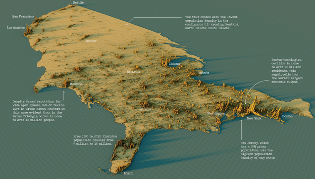
@conradhackett When I was at Bell Labs in 1970s, the Bell System had 3 types of economic/engineering planning areas: 1: rural 2: suburban/urban 3: New York City Your visualization illustrates why...