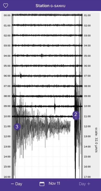
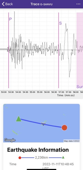
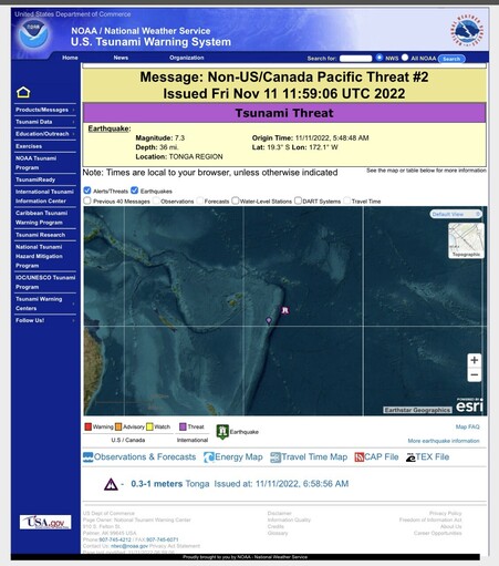
M7.3 earthquake (magnitude may change as more data becomes available) in the Tonga region.

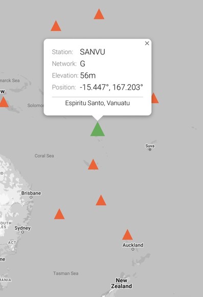
The region near todays M7.3 earthquake is incrediblely active due to the high rates of convergence between the Australian and Pacific Plates. Since 1900, 40 M7.5+ earthquakes have been recorded, as well as at least 3 M8+ events.

#earthquake #tonga #geology

https://earthquake.usgs.gov/earthquakes/eventpage/us7000ip0l/region-info

Immediately after large earthquakes, different agencies may report somewhat different magnitudes, and those magnitudes may change as more information becomes available.

Remember - #science is a process, and conclusions can change with new #data.

This video gives additional information on we calculate (and why we sometimes adjust) earthquake magnitude.

https://www.iris.edu/hq/inclass/animation/magnitude_changing_the_magnitude_downgradingupgrading

Magnitude: Changing an Earthquake's Magnitude (downgrade/upgrade)- Incorporated Research Institutions for Seismology

Why do seismologists change the magnitude of an earthquake? Obtaining an accurate preliminary magnitude can be difficult due not only to the complex processes that occur deep within the Earth, but because there are over a dozen techniques of for calculating the magnitude of an earthquake. 

These images shows the seismic recording of the earthquake waves on a station in Vanuatu. The station is indicated by a green triangle. Look at near real time seismic data from stations around the 🌎 using Station Monitor https://www.iris.edu/app/station_monitor/
Station Monitor

Station Monitor provides access to continuous, real-time ground motion from hundreds of locations around the globe.

This #earthquake has generated a small #tsunami. If you are in an area that may be impacted, move away from the water and get to higher ground.

Listen to instructions from local authorities.

Stay safe.

https://www.tsunami.gov/?p=PHEB/2022/11/11/22315000/2/WEPA40

Tsunamis occur when the ground beneath the ocean is displaced, usually during an earthquake. The ground lifts up, also lifting up the water above it. The water then flows outward in all directions - this is the tsunami.

This animation from IRIS shows the convergence between a continental and oceanic plate, whereas the earthquake near Tonga occurred on an oceanic oceanic plate convergence. But the idea is the same.