The European Ground Motion Service (EGMS) does not stop to amaze me (Disclaimer: I work at a company involved in its implementation).
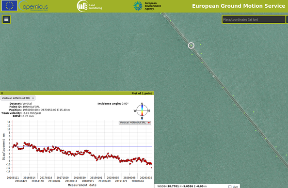
It provides a very dense Pan-European point-wise mapping of surface displacement with millimeter accuracy. Measurements are based on Sentinel-1 time-series (Synthetic Aperture Radar Interferometry) and currently cover up to 6-day intervals from 2016 to 2020. Just browsing through the maps already reveals a variety of processes... some examples:
It provides a very dense Pan-European point-wise mapping of surface displacement with millimeter accuracy. Measurements are based on Sentinel-1 time-series (Synthetic Aperture Radar Interferometry) and currently cover up to 6-day intervals from 2016 to 2020. Just browsing through the maps already reveals a variety of processes... some examples: