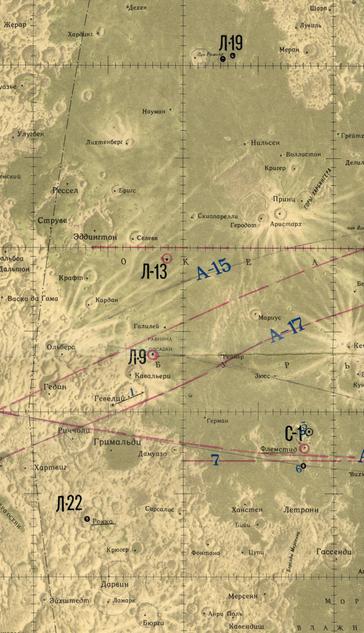
This is the image with some of that ambiguity clumsily removed. It's not just images, we also get surface roughness estimates. But is it useful? The interesting thing that comes from this is that a year after Luna 22 did this, the method was used at Venus by Venera 9 and 10 (more famous for their surface images), where it was the only way to get such details of the surface. Again, these lunar orbiters were testing methods for planetary exploration. #moon #luna22
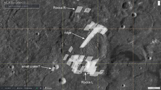
(My interpretations here are from the Russian paper). If the bright reflection at the bottom is that crater ejecta, we can remove its ambiguous 'echo' from the top (next post). Some reflections at upper left may be from the north wall of Rocca R so their echoes can be removed at bottom left. One bright spot at lower left might be from a small fresh crater, so it is retained but removed at top left. It's a bit ad hoc but the best we can do. #moon #luna22
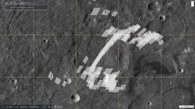
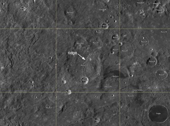
Here is Rocca, a c. 60 km diameter crater at 13 south, 72 west, mantled by Orientale ejecta. A ridge crosses its floor where Orientale ejecta has piled up against the downrange crater wall. A fresh smaller crater sits on Rocca's southern rim. The straight line in the radar image is that ridge, and strong reflections at the south end are from the rocky ejecta of the smaller crater. I made a composite of all 3 radar images to overlay on the crater... #moon #luna22
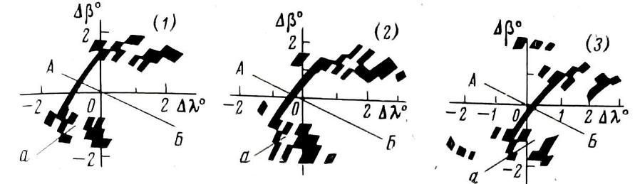
This is what the 'pictures' look like. The black marks are bright reflections. The pattern drifts across a grid fixed to the spacecraft as Luna 22 passes over the crater. A-B is an axis of symmetry and the image is north-south ambiguous across it. You can't tell if a specific reflection comes from north of the line or south of it. What can we do with this? Let's look at the Rocca crater area. #moon #luna22
I will look at the Luna 22 bistatic radar observation in more detail than it probably deserves because it is so little known. It was made at a crater called Rocca, involving 3 observations as the orbiter passed overhead. Here is the citation:
Zaitsev, A. L. et al. 1977. Bistatic radar surveillance of the moon, using a modulated signal. Radiotekhnika i Elektronika, v. 22, Oct. 1977, p. 2097-2104.
A friend helped me find it in the Lenin Library. #moon #luna22
Zaitsev, A. L. et al. 1977. Bistatic radar surveillance of the moon, using a modulated signal. Radiotekhnika i Elektronika, v. 22, Oct. 1977, p. 2097-2104.
A friend helped me find it in the Lenin Library. #moon #luna22
Here is another section of that Russian map I saw at MIIGAiK. The dots marked L-19 and L-22 are the important points here. At the time I didn't know what they were. Now I know they were radar observations made using the altimeters. I mentioned the Luna 19 points earlier - they are actually 2 contiguous tracks of radar reflectivity data. For Luna 22 we get actual bistatic radar images - we will see them tomorrow but don't hold your breath until then.
#moon #luna22
#moon #luna22
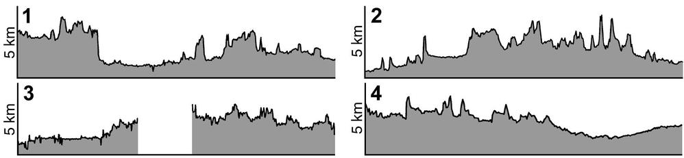
These are Luna 22 radar altimetry plots from that old Soviet-era publication. The vertical scale is shown, the same for each track. The plots match real features so we know they are correctly placed - number 2 crosses the large flat-floored crater Ptolemaeus, number 1 crosses Sinus Asperitatis and suddenly rises as it meets highlands to the west. Apollo altimetry was more extensive but did not cover this area (not until Clementine did we get our our first global topographic map). #moon #luna22
The paper cleared it up - some end-points of lines had been mis-plotted, not just in latitude but also confusing east and west longitude. The paper allowed me to draw the lines correctly. They match the pattern of images too, as you would expect. Only these tracks were made, again testing for planetary use. And we actually have the altimetry - which we will see tomorrow.
#maps #moon #luna22
#maps #moon #luna22
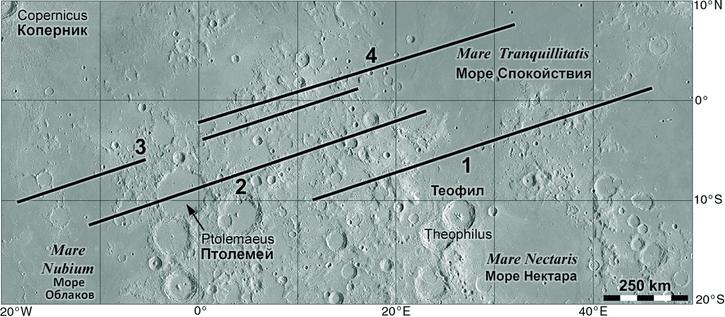
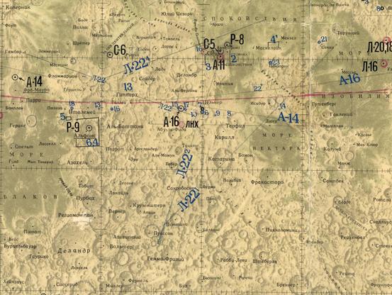
I scanned this map at MIIGAiK in Moscow in 2001. It had been annotated with landing sites and other information (C-5 is Surveyor 5, P-8 is Ranger 8). The L-22 lines are altimetry tracks but 2 of them end about 30 deg. south. The orbit inclination would not allow that. Then my hosts found an obscure paper:
Tyuflin, Y. C. et al., 1976. Nekotorie resultat radioprofilirovaniya s avtomaticheskoi stantsii Luna-22. Kartografirovanie Lune i Planet, pp. 54-58. MIIGAiK, Moscow.
Actually there must be other panoramas merged into the overlapping area. Don Mitchell also has Luna 22 images here:
http://mentallandscape.com/C_CatalogMoon.htm
(near the bottom of the page) but they don't add any more to the map.
As with Luna 19, these images are not useful for studying the Moon and we can only make sense of them as tests of cameras designed for Mars or other places. Scanning imagers were flown on Mars 4 and 5. #moon #luna22