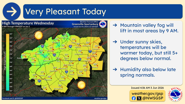
#GSP#SCwx#GAwx Mountain valley fog will lift in most areas by 9 AM. Under sunny skies, temperatures will be warmer today, but still 5+ degrees below normal. Humidity also below late spring normals.
#GSP#SCwx#GAwx The temperature roller coaster continues today, with temps expected to be around 10 degrees cooler than Monday. Scattered rain showers are expected, mainly across the western half of our area. Today will be the last day with a chance of rain until at least this weekend.
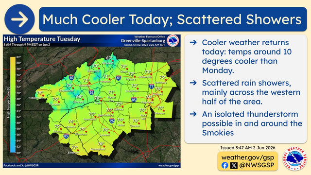
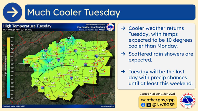
#GSP#SCwx#GAwx The temperature roller coaster continues Tuesday, with temps expected to be 10 degrees cooler than Monday. Scattered rain showers are expected, but Tuesday will be the last day with a chance of rain until at least the weekend.
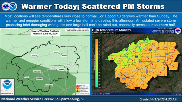
#GSP#SCwx#GAwx Most locations will see temperatures very close to normal…or a good 10 degrees warmer than Sunday. The warmer and muggier conditions will allow a few storms to develop this afternoon. An isolated severe storm producing brief damaging wind gusts and large hail can’t be ruled out, especially across our southern half.
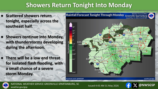
#GSP#SCwx#GAwx Scattered showers return tonight, especially across the southeast half of the area. Showers continue into Monday, with thunderstorms developing during the afternoon. There will be a low end threat for isolated flash flooding tonight into Monday, with a small chance of a stray severe storm Monday afternoon.
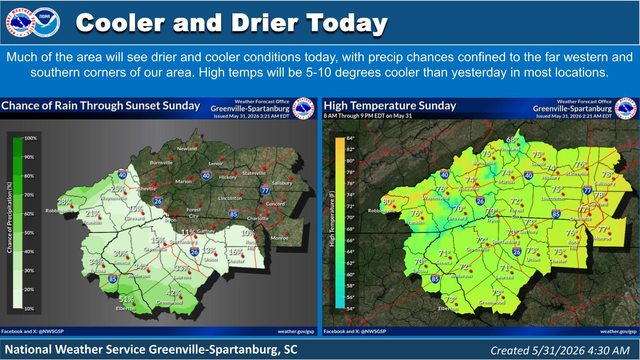
#GSP#SCwx#GAwx Much of the area will see drier and cooler conditions today, with precip chances confined to the far western and southern corners of our area. High temps today will be 5-10 degrees cooler than yesterday in most locations.
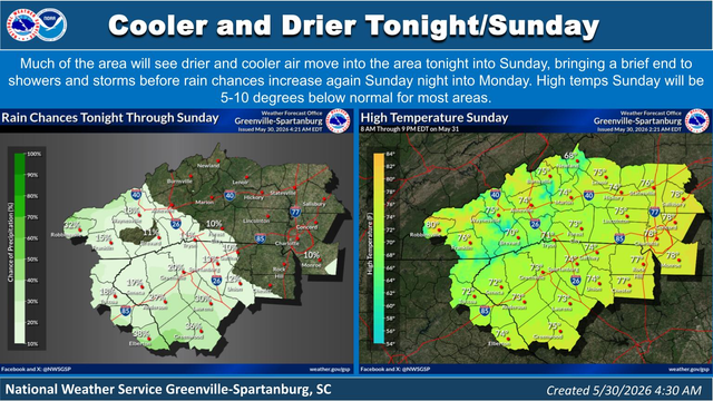
#GSP#SCwx#GAwx Much of the area will see drier and cooler air move into the area tonight into Sunday, bringing a brief end to showers and storms before rain chances increase again Sunday night into Monday. High temps Sunday will be 5-10 degrees below normal for most areas.
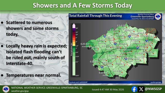
#GSP#SCwx#GAwx Scattered to numerous showers and some storms today. Locally heavy rain is expected. Isolated flash flooding can’t be ruled out, mainly south of Interstate-40. Temperatures are forecast to be near normal.