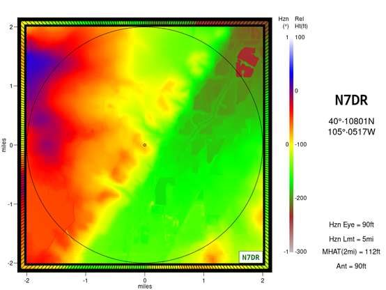
Uploaded a new repository to github. https://github.com/N7DR/drmap2 is functionally more-or-less-identical to https://github.com/N7DR/drmap, but uses the GeoTIFF-formatted elevation files made available by #USGS. These have replaced the old GridFloat files that were used by the original #drmap, and are no longer available from USGS.

#drmap2 #geotiff #hamradio

Went to update #drmap (https://github.com/N7DR/drmap) to C++23, and discovered that the #usgs has helpfully completely changed the way that US elevation data are formatted and accessed; naturally, the new system is considerably more complicated than the old one.

So now I have an unexpected chunk of work ahead of me to figure it all out and convert the drmap program to use the new format (which will doubtless change again -- why can't data suppliers just leave things alone?)

GitHub - N7DR/drmap: US mapping for amateur radio purposes

US mapping for amateur radio purposes. Contribute to N7DR/drmap development by creating an account on GitHub.

GitHub