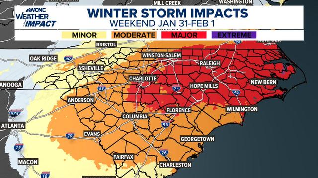
❄️ HUGE Spread in Snow Potential + Major Travel Impacts Saturday❄️
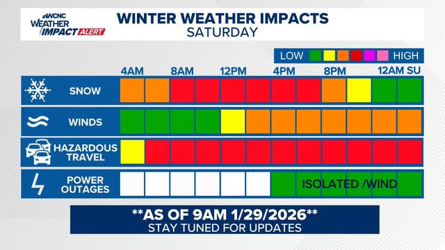
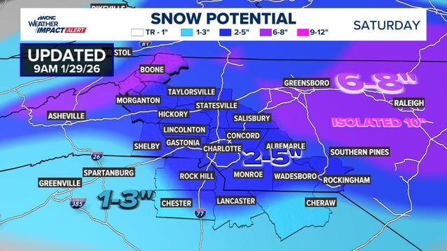
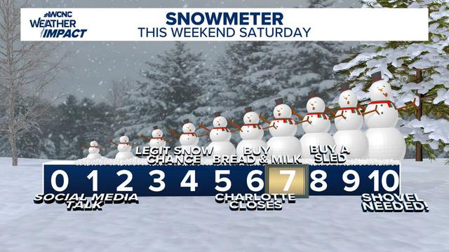
This weekend’s setup is a classic "Boom or Bust" scenario, but even the "bust" keeps us snowy. Right now, our Most Likely outcome puts the metro area in the 2-5" range, but if those bands set up just right, the "Boom" potential for 6- 8" is very real, but in isolated spots mainly east of I-77. The biggest concern isn't just the totals—it’s the wind and cold. We’re looking at likely near white-out at times with significant drifting, making the roads treacherous regardless of how many inches officially stack up. Slick travel is our #1 concern. Saturday looks rough from start to finish. If you don't have to be on the roads, stay home. Windchills will be in the single digits at times, with highs only in the mid-20s. Vlog will be out shortly.
Stay tuned—this system is evolving fast! 🌨️
#snOMG #cltwx #ncwx #scwx #wcnc #SnowMeter #WinterStorm