#CAwx #SGX #graphicast
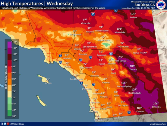
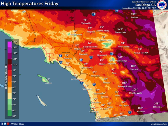
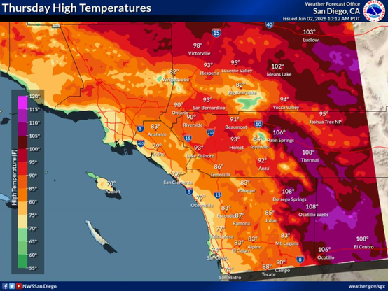
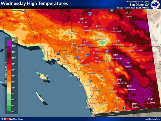
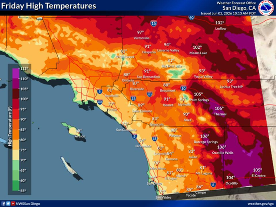
A bump up in temperatures is expected Wednesday, bringing areas of minor to locally moderate HeatRisk in the Inland Empire and more widespread moderate HeatRisk in the Coachella Valley and San Diego County deserts through the end of next week. For this period, highs will generally range from 90-96°F in the Inland Empire and 105-110°F in the Coachella Valley and low deserts.
A bump up in temperatures is expected Wednesday, bringing areas of minor to locally moderate HeatRisk in the Inland Empire and more widespread moderate HeatRisk in the Coachella Valley and San Diego County deserts through the end of next week. For this period, highs will generally range from 90-96°F in the Inland Empire and 105-110°F in the Coachella Valley and low deserts.