Free menstrual products available.
You can also enter this in the ID Editor at OSM. This must be new.
#ideditor #OpenStreetMap #osm
You can also enter this in the ID Editor at OSM. This must be new.
#ideditor #OpenStreetMap #osm
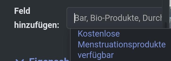
Man kann im ID Editor angeben:
Kostenlose Menstruationsprodukte verfügbar.
Cool, wo gibt es denn sowas ?
--+--
You can specify in the ID Editor:
Free menstrual products available.
Cool, where's that?
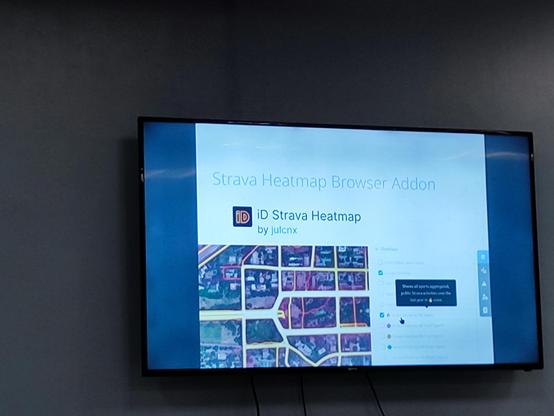
Something I find annoying on the #OpenStreetMap website is that the aerial imagery layers available in edit mode are not also available when just browsing the map (i.e. when you're not in edit mode).
Why can't I easily view these layers without editing the map?
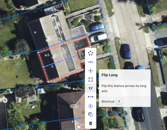
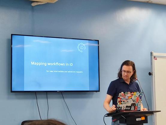
MAPPING WORKFLOW IN iD
Presentation by Martin Raifer
Discover the latest insights on efficient mapping workflows using iD! #SOTMManila #iDeditor #sotm2025 #sotm2025manila #OpenStreetMap
I surveyed part of a housing estate today where some houses are in various stages of being built. Using #EveryDoor I added a node for each house and marked them as 'construction'.
Later in #iDEditor I made some adjustments to their position and addresses. I noticed that iD doesn't seem to like buildings being nodes, in that relevant feature types aren't available to select.
So how best to map buildings under construction, when there are no aerial images to trace as areas?
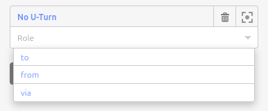
Is it just me, or does the drop-down option for a restriction relation's role not appear for nodes...?
When I add a way to a relation, I can see the drop-down, but not when adding a node.
How do you check to see what date aerial imagery for #OpenStreetMap was taken? I'm specifically referring to the imagery available in the online #iDEditor.
Also, was all the imagery from a particular source, for an entire Australian state like NSW (for example), taken at the same time? Or, as you pan around the map, are you potentially seeing different dated imagery?
