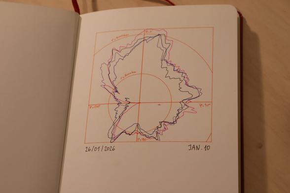
For #genuary10 "polar coordinates", I wanted to take the prompt quite literally and draw a map of the poles.
The sketch shows Antarctic sea-ice extent in September for the years 2005 (pink), 2011 (purple), 2018 (blue) and 2025 (black), in a radius range ~2500 to 4000 km from the pole.
The data is from #NOAA #NSIDC and its continuation is threatened by US administration budget cuts on climate research.
#genuary #genuary2026 #genuary10 #antarctic #climate #dataviz #plotter