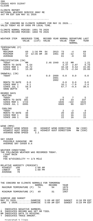
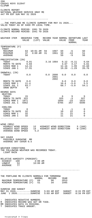
#MEwx #GYX #graphicast
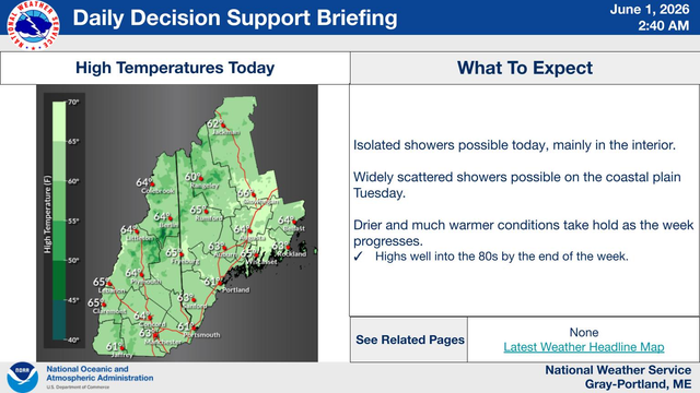
Low pressure will continue moving southeast across the region, leading to scattered showers and maybe a few rumbles of thunder through the morning. A few more isolated showers are possible later this afternoon. A warming trend with slightly above average temperatures to end the week. Chances for precipitation Tuesday and next weekend, but no day is expected to be a washout.
Low pressure will continue moving southeast across the region, leading to scattered showers and maybe a few rumbles of thunder through the morning. A few more isolated showers are possible later this afternoon. A warming trend with slightly above average temperatures to end the week. Chances for precipitation Tuesday and next weekend, but no day is expected to be a washout.