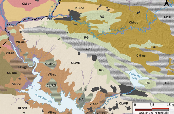
With colleague from #tubingenuniversity #LMU #palermouniversity and #dohukantiquity we are pleased to present our new study on #DigitalSoilMapping 🗺️for the Dohuk directorate in the autonomous Kurdistan region of Iraq 🇮🇶
This represent the first quantitative study on soil component in the region
« Soil information and soil property maps for the Kurdistan region, Dohuk governorate (Iraq) » https://doi.org/10.5194/essd-18-2507-2026
This represent the first quantitative study on soil component in the region
« Soil information and soil property maps for the Kurdistan region, Dohuk governorate (Iraq) » https://doi.org/10.5194/essd-18-2507-2026