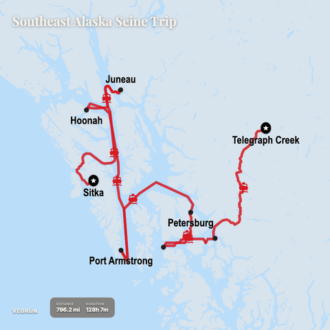
Working on a mapping project. Here is an example of an all-water Southeast Alaska route starting up the Stikine River in BC Canada. Where there is a ferry, it follows those routes (Juneau-> Sitka); otherwise, it calculates a water route. It's built for social media, so it's not fully navigable. It also snaps to marine routes which is probably the cause of the backtracking at Port Armstrong. The transition from river to inland waterways has taken a lot of work.