Some spots are lucking out with 1–2″ of rain tonight! The rain area will gradually weaken over the next few hours.

WeatherPulse
@weatherpulse
- 1 Followers
- 1 Following
- 163 Posts
Weather for Indiana, Kentucky and Ohio.
Showers and storms bubbling up to the north. This activity will stay south of Cincinnati before fading away later this evening.
Holy Batman! What is this showing up on radar? Showers are popping up across portions of Oldham and Henry Counties this morning. #kywx
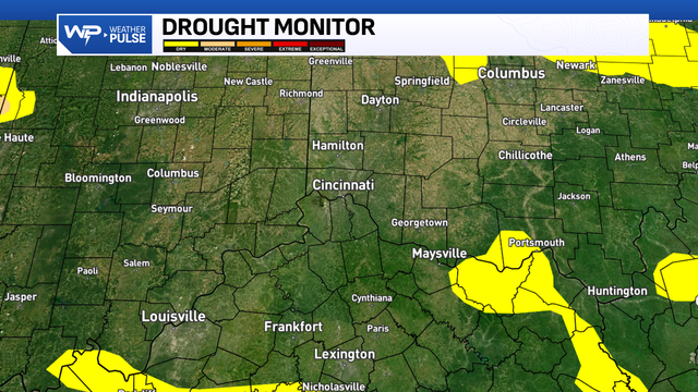
Parts of Kentucky are starting to see abnormally dry conditions, especially in northeast and south-central areas. Mason County has now been added to that list, and in fact, a burn ban is currently in place for the county. Hard to believe, considering how much rain we’ve had this season.
I'd be on standby if you live in the Florence and Union, KY area. 50-60mph winds are moving in! #kywx
Watching other storms moving through Harrison and Dillsboro areas. These storms are producing lightning, heavy rain and some wind. Not severe. #inwx
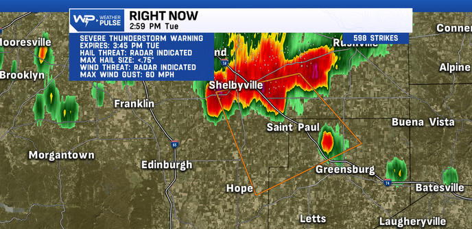
New Severe Thunderstorm Warning for Northeastern sections of Decatur County., IN until 3:45pm. Damaging winds are the primary concern. #inwx
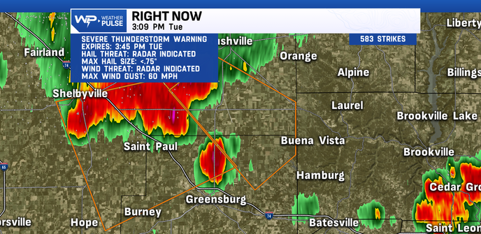
Severe Thunderstorm Warning has been issued for Northwest Decatur Co., IN until 3:45pm. Damaging winds is the primary threat. #inwx
One lone shower at this hour moving into Franklin Co., IN this should stay west of Brookville lake. #Inwx