🚀 Big news for #JupyterGIS users!
Two powerful new features are now live:
✅ Built-in STAC catalog browser - Seamlessly explore geospatial datasets.
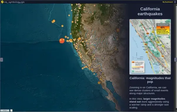
✅ Story Maps editor - Create and share interactive story maps directly from Jupyter.
Discover, analyze, and tell stories with geospatial data - all in one place.
📖 Learn more on the Jupyter Blog: https://blog.jupyter.org/expanding-geospatial-workflows-in-jupytergis-stac-browsing-and-story-maps-7fb98eece82e
🌍 Try it live in your browser: https://notebook.link/@quantstack/earthquakes-story-map