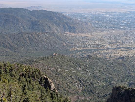
open space in the foreground is Bear Canyon, a floodway. Open space in the background is Kirtland AFB. Tramway's very wide ROW is apparent crossing Bear Canyon. For a long time I assumed that Tramway's big-ass ROW (500' clear and wider in some areas) was in preparation for a future freeway---this was the Robert Moses era and proposed freeways were all over Albuquerque. Having read into it more, though, I don't think that was the case. Tramway was always understood to be part of the "loop highway" project (which has never fully materialized), but that wasn't going to be freeway. The wide ROW was mostly just out of caution, perhaps from the painful experience of the (still incomplete) widening of Lomas. It has allowed the city to shift an arroyo onto Tramway and for a pretty nice muli-use path on the east side.

J. B. Crawford
- 147 Followers
- 28 Following
- 668 Posts
Author of computer.rip. DevOps engineer. Telecom history enthusiast. Desert rat.