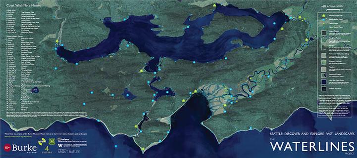
"The Waterlines Project Map (PDF) is a rendering of the Seattle region in the mid-19th century, just prior to non-Indigenous settlement."
What took me by surprise is the giant river delta.
Click through to the full PDF and there's outlines of the current coastline.
https://www.burkemuseum.org/static/waterlines/project_map.html