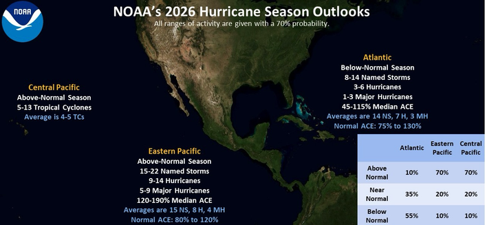
NOAA/NHC issues annual 2026 Hurricane outlook. Just general guidance on if more or less storms likely for reference.
Overall El Niño conditions likely favor more storms in East & Central Pacific (warmer waters) and less storms in Atlantic(higher wind shear).
21May2026
2026 Atlantic Hurricane season starts in just 100 days. Here are the names for this year:
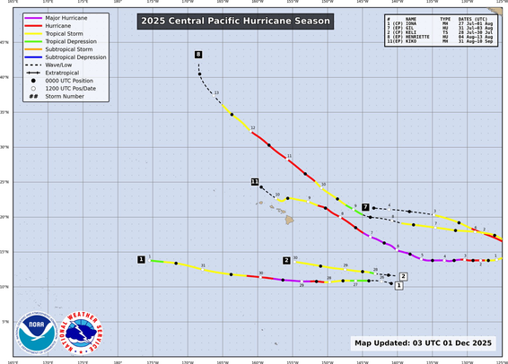
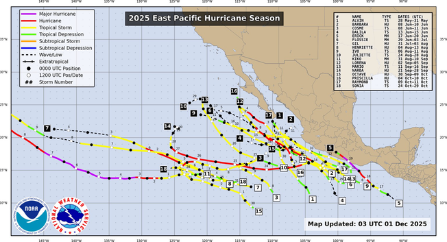
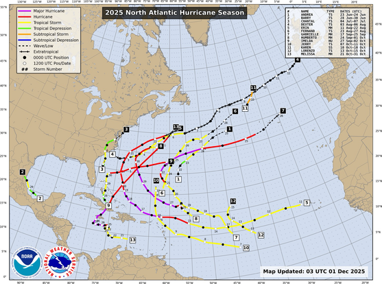
Hurricane ‘season’ for the Atlantic, Central/Eastern Pacific comes to a close this evening 30Nov. 2025 storm tracks shown here. While storms can form in any month, the season changes bring cooler waters and high wind shear limiting their potential as head into winter.
Tues 28-Oct 11pEDT/AST,10pEST: winds 130mph(215km/h), moving NE 9mph(15km/h), pressure 950mb.
Hurricane winds extend up to 30miles(45km) from center.
TS winds up to 195miles(315km).
Storm center about 65miles(105km) North of Jamaica.
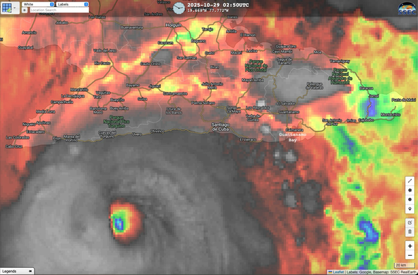
About 45miles(72km) South of Cuba.
About 68miles(110km) Southwest of Santiago, Cuba.
About 98miles(158km) West-Southwest of Guantánamo Bay, Cuba.
Eye of Hurricane Melissa returning on satellite as heads towards Cuba Tuesday evening. 28oct2025
Mountains of Jamaica and land interaction clearly disrupting Hurricane Melissa by late Tuesday 28oct2025
Hurricane Melissa beginning landfall into Southwest Jamaica. Core winds likely moving onshore with eye / eye wall area. 930aEST/1030aEDT 28oct2025
Melissa nearing Jamaica
7aEST 28oct
Center about:
34miles(55km) SW Treasure Beach.
36miles(58km) SW Parottee Bay.
40miles(64km) SSW Black River.
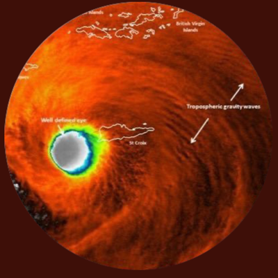
Eye 11.5miles(18.5km) diameter.
Strongest winds around that eye.
Hurricane winds extend up to 30miles(45km) from center.
http://hurricanes.govIf there’s any ‘good’ news with a Cat5 landfall its those intense winds are confined to a smaller area.
As of 8pEDT/7pEST Monday 27-Oct2025 Hurricane force winds (74 to 175mph (120 to 280km/h)) extend out 30miles(45km) from center. (These numbers do fluctuate over time).
Hurricane Melissa. Jamaica.
175mph(280km/h) Cat5 Hurricane Melissa starting its anticipated turn towards Jamaica 27-Oct2025 1pEST,2pEDT/AST