๐Ÿ‡ฎ๐Ÿ‡ท๐Ÿ›ข๏ธ ๐—ž๐—ต๐—ฎ๐—ฟ๐—ด ๐—œ๐˜€๐—น๐—ฎ๐—ป๐—ฑ ๐—ข๐—ถ๐—น ๐—ฆ๐—ฝ๐—ถ๐—น๐—น: ๐—•๐—น๐—ผ๐—ฐ๐—ธ๐—ฎ๐—ฑ๐—ฒ ๐—–๐—ผ๐—ป๐˜€๐—ฒ๐—พ๐˜‚๐—ฒ๐—ป๐—ฐ๐—ฒ๐˜€

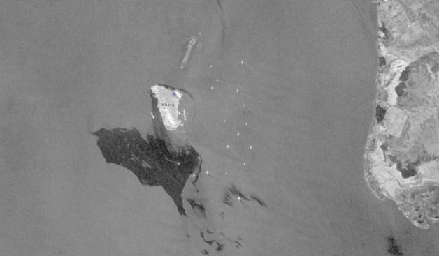
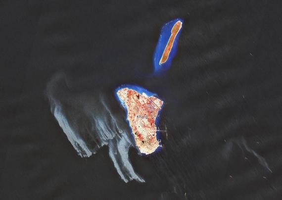
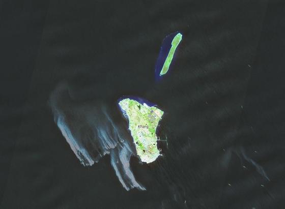
BLUF: Copernicus Sentinel satellite imagery from May 6, 2026, confirms a large oil slick covering approximately 45 square kilometers west of Kharg Island, Iran's primary crude oil export hub handling 90% of the country's exports. The cause is unconfirmed. Iran is calling it psychological warfare and blaming a European tanker.
1/4

Satellite imagery from May 8 shows no evidence of active new spilling, suggesting the release has stopped or slowed.

The most analytically consistent explanation is storage overflow.

The U.S. naval blockade has trapped dozens of tankers and halted exports since mid-April. Kharg had an estimated 12-13 million barrels of spare onshore storage with inflows of approximately one million barrels per day.

Iran had weeks to reduce production and avoid this.
2/4

Fully shutting in mature oil wells carries its own long-term infrastructure risks, including permanent reservoir damage and production losses. The regime chose to protect its long-term production capacity.

The Persian Gulf is a semi-enclosed sea shared by Iran, Saudi Arabia, UAE, Kuwait, Qatar, and Bahrain.

Desalination plants, fisheries, and coastal ecosystems across the entire region are at risk.
3/4

If the source of the spill is accurate, it does appear Iran chose protecting its oil infrastructure over the Gulf it shares with its neighbors.

SOURCES: Reuters | Copernicus Sentinel | Conflict and Environment Observatory | Arab News | Jerusalem Post

#OSINT #Iran #OperationEpicFury #BloodOil
4/4