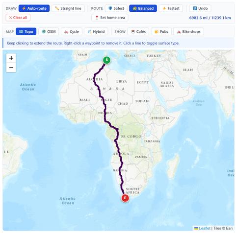
Testing the #WillCycle route builder, by setting the starting point as the northern-most part of Africa, and the end as the southern-most part, with no waypoints in between.
Wow. It calculated the route! 6 983.6 miles.
I wish I had the time, and the money, to attempt to ride it.
Overall, I'm really happy with it, though there are some improvements needed:
1) I need to add a "full screen" option
2) I need to fix some issues with the route elevation profile
I can't take credit for the routing it does though: that done by the superb, open-source BRouter library.
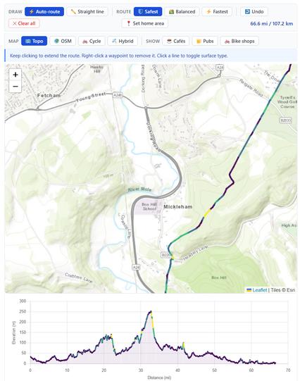
On routes that aren't monstrously huge, the route colour on the map changes, indicating gradients, as the screenshot shows.
The gradient colours are optimised to not exclude colour-blind people, though I might tweak that some more.
The route builder also allows custom waypoints to be added, which are then embedded in the resulting GPX file.
What custom waypoints? That's up to you! I like to add additional info about the route, eg adding the names of rivers that I cross, etc.
You could add "Café 200 metres to your left", etc.
The route builder's available here: www.willcycle.com/route-builder/
Ordinarily, it's for members only, but for Easter, I'm opening it to everyone to use.
Go test it out!
WillCycle Supporters - WillCyc...
WillCycle Supporters - WillCyc...

Route Builder - WillCycle
The WillCycle Route Builder is deliberately basic. It offers just the functionality you need to build a route, and nothing more. You can switch between different maps, choose to display Points of Interest (PoIs), such as cafés, pubs, or bike shops, and you can add additional information. If navigating your own route, using this site,