
@TaiwaninMchrome those flags are very happy!
And it has been a while since the roads had so little traffic here 😅
@imrehg Photo published 1939 showing a scene from the Taiwan Exposition of 1935 to celebrate the 40th anniversary of Japanese rule.
This image is of part of Site No. 1 of the Exposition, which started at Taihoku Meeting Hall (present-day Zhongshan Hall) and ran southward along the Three Line Road (present-day Zhonghua South Road). Based on the trees, this appears to be part of the Three Line Road.
第一會場南門興行地(第一會場附屬地) https://dl.lib.ntu.edu.tw/s/photo/page/list #taiwan #taiwanhistory #taiwanphoto
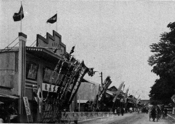
@imrehg You can actually draw a straight line (so to speak) from Taihoku’s Three Line Road to modern Taipei’s tree-lined boulevards like Ren-ai Road and Dun-hua Road.
With the Meiji Restoration, the Japanese dispatched people to Europe to collect knowledge and skills from the West. Along with Western architecture, law and technology, one of the ideas these people brought back was that a key attribute of a grand international city was its broad, tree-lined avenues.
@imrehg When the Japanese authorities demolished the Taihoku city walls, they used the resulting space to ring the city with the Three Line Road / 三線道路, with a main central lane, two lanes for slower vehicles on either side, and each lane separated by a strip of trees.
The concept is directly reflected in the tree-lined boulevards of modern Taipei’s Ren-ai Road and Dunhua Road.