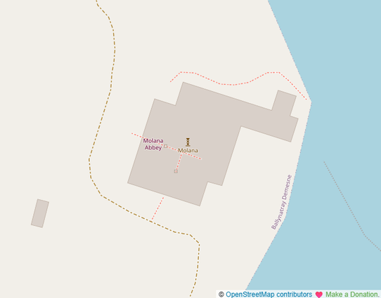
Is there any way on #OpenStreetMap to have a relation type building with `building:parts` within a relation type `multipolygon`. Especially for monasteries where the cloister garth is the `inner` part of the multipolygon, that would be really helpful, but I never seem to get it right. It is always rendered as a whole big blob of a building: https://www.openstreetmap.org/way/823821717.
@BUnicycling the multipolygon should have the building tags, not the outer way. But the problem is, this isn't a building, this is a ruin. If you want to map it as it once was, I suggest openhistoricalmap. There you can have the whole context of that point in time on the map.
@janjko all the parts are building:part=ruin and the outline is building=ruins, so I don't see what the problem is.

@BUnicycling According to the wiki:
The tag building=ruins is frequently used to mark abandoned, ruined buildings. However, according to the meaning of building=*, this tag should be used for a building constructed as ruins (for example sham or scenic ruins in an English landscape garden)...

https://wiki.openstreetmap.org/wiki/Tag:building%3Druins

Tag:building=ruins - OpenStreetMap Wiki