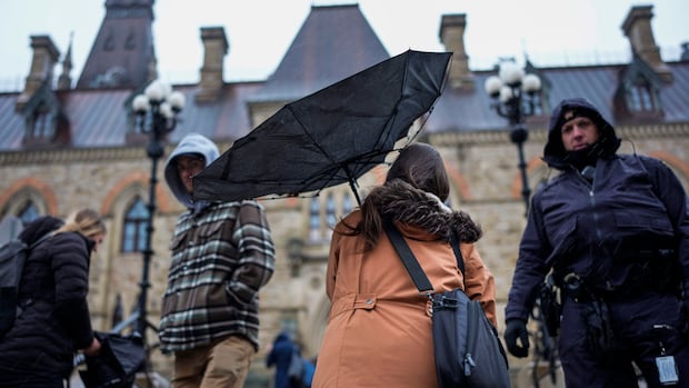
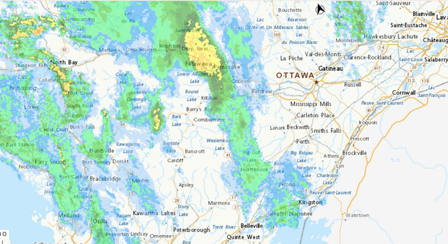
A severe thunderstorm watch has been issued for Ottawa-Gatineau

https://www.cbc.ca/news/canada/ottawa/ottawa-thunderstorm-weather-forecast-9.7130390
- - -
Une veille d’orages violents a été émise pour Ottawa-Gatineau

https://meteo.gc.ca/fr/location/index.html?coords=45.403,-75.687

#Ottawa #YOWwx #MétéoYOW

Winter thunderstorm watch comes with temperature spikes | CBC News

Late-winter thunderstorms could signal a drastic temperature change in communities such as Ottawa, Cornwall and La Pêche Monday afternoon.

CBC

@EdwinG "Les conditions routières pourraient être difficiles. Des pannes de courant sont possibles par endroits. Des dommages aux toits, aux clôtures, aux branches ou aux abris souples sont possibles."

Translation: It may rain in Ottawa.
(curious why they have a yellow alert for this. )(

Front is moving to north-east so the yellow blob won't come close to Ottawa,

@jfmezei The yellow alert is for the risk of severe thunderstorm. That’s highly unusual this early in meteorological spring.

@EdwinG Unless there is a a storm approaching the city, this should be a grey alert.

The message does NOT contain "meteorologists are currently tracking a storm that is heading towards Ottawa". So shouldn't be a yellow alert.

@EdwinG @jfmezei

And said Yellow Alert is … not helpful. No predicted timelines, no confidence bars.

You can name it the "Ontario Storm Prediction CentRE" but their outlook products are nothing like the US NWS Storm Prediction CentER. Bias? Yes, I used to work one floor up from them but I also know how good they are.

I am confident that ECC forecasters are just as skilled & dedicated as those at SPC (and the other *122* regional NWS FOs) but are hobbled by an uncaring Parliament.

@VE2UWY @EdwinG

A front did pass ottawa but nothing meaningfull. BUt a new one popped up moving north/north-east between Ottawa and montreal.