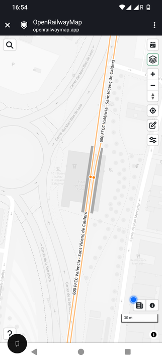
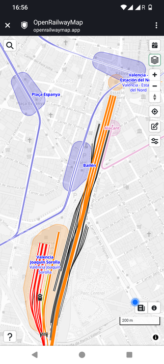
Are SNCF's TGVs too big for Italian tunnels?

The answer: check a map

But the problem: I do not know of a public loading gauge map for all Italian lines

Can anyone point me to one?

Grazie mille! Merci beaucoup!

https://www.lesechos.fr/industrie-services/tourisme-transport/tgv-ces-32-centimetres-qui-menacent-le-plan-de-conquete-de-la-sncf-en-italie-2220844

@jon would that make sense to include in openrailwaymap? Is that information published elsewhere?
@grischard There is a field in the OpenRailwayMap data set for it, but for loads of lines it is empty. For France, for example, there is a SNCF published dataset. But for Italy I don't know.
@jon tangent: have you see the new https://openrailwaymap.app ?
OpenRailwayMap

@grischard Yes! I am not sure if I like that interface better or not yet :-)
@jon @grischard
I am slightly confused by the blobs on that map interface. At first they look like the extent of platforms but they aren't really that.
@brunogirin @jon These? I think they’re supposed to make it easier to differentiate station areas?
@grischard @jon
Yes, that's what I thought until I noticed some stations don't have it or only have what looks like a default size circle. Is there a way to suggest fixes?
@brunogirin @jon do you have an example? Probably tagging in OpenStreetMap
@grischard @jon
Two examples in Valencia:
- Cabañal doesn't show anything
- Estación del Norte only shows a small orange circle at the entrance (compare to the orange blob of high speed station Joaquin Sorolla next door)
@jon the .app has a loading gauge setting, and some data for Italy!
@grischard Yes, but sadly NOT for the lines I need to check!
@jon
I assume the answer is different for classic TGV vs TGV Duplex?
@brunogirin Yes, exactly. The single deck TGVs that run in Italy already present no issue. SNCF now wants to run double deck ones.

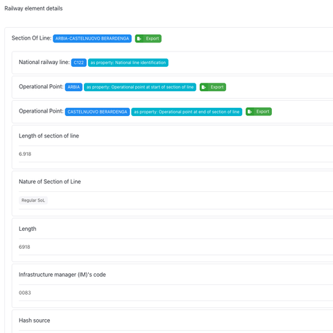
@jon If you don’t get a better answer, there may be something in the Fascicoli Circolazione Linee or thereabouts: https://normativaesercizio.rfi.it/NormativaEsercizio/

(I can’t check right now. Mobile coverage is so bad, at one point my phone booked itself into “A1 BY” which can’t be good.)

Donet - Circolari Territoriali e Fascicoli Circolazione Linee 5.0.14

@partim @jon Doesn't look like it, or at least it's incredibly hard to pick out from the wealth of info within, but I am positively surprised those are even public
@partim @jon Also, yeah, it's easy to forget that it's a good idea to put your phone on manual network selection near EU external borders (including those of a certain country using a Latin-based abbreviation for its country code)
@HaTetsu @jon I didn’t even think of it. The line is, like, ten kilometres away from the border.
@jon it’s actually surprising that the larger TGVs can squeeze through the older tunnels all the way to Ventimiglia
@grischard TGV double deck gauge is 4.3m high, in Switzerland and Germany 4.6m... so I am not surprised.

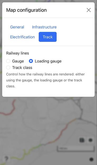
@jon https://data-interop.era.europa.eu/map-explorer if you click on a line on this map and then click on a track in the pop-up it will tell you the loading gauge

if you're doing it enough that that's annoying and no-one else has bothered, i can probably hack together a map from the data

RINF - Register of Infrastructure

@bovine3dom Except it doesn't, in Italy...

@jon i tried it for three different random places in Italy and they all did 🤔

are you definitely clicking on a "track" not not a "line"?

@bovine3dom I want the details on these north of Roma, but I get Line when clicking. How do I even get Track?
@jon are you planning a channel terminal at the vatican? who would pay for the swiss guards doing the border formalities
@bovine3dom No. I am checking French press bullshit about the loading gauge of TGVs
If there's a priest saying mass on board, then passengers should happily donate 😊
@bovine3dom @jon interesting. Is there an API or download for the ERA track-data?

@wnd lol i was going to ask _you_ that :)

best i found so far is that you can click around and select an area to export

@jon

@bovine3dom @wnd @jon Have you tried going to Apps > Dataset Explorer?
@HaTetsu @bovine3dom @jon yeah kind of but it seems to want me to write some kind of RDF triple query. Which is not my jam
@wnd @bovine3dom @jon I think that was Resources > Endpoint, though? Dataset Explorer seems to have, well, per infra manager dataset download links

@HaTetsu their server didn't like it when i asked for loading gauge so i wrote my own xml parser

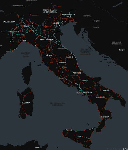
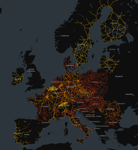
i think we're getting somewhere. red is more restricted gauge, i think, and blue is less restricted?

if anyone can point me at a 'Gauge=20 => "GB"' dictionary and, even better, a big dictionary of 'my gauge => compatible gauges', i can make a nice map of 'i bought four billion quid's worth of trains now let's see where can i go with them'

@wnd @jon

@bovine3dom @HaTetsu @wnd @jon There certainly is a reason why all the new double decker trains in Germany are terrible upstairs. G2, I want to say?
@partim @bovine3dom @HaTetsu @wnd I thought Alstom was making the new Coradia for Niedersachsen larger? But yes, essentially, GB is the reason.
@jon @bovine3dom @HaTetsu @wnd It’s possible. They are going to be owned by the state, so reuse on other lines elsewhere is unlikely. And they’ve been using the big Bombardier Dostos for ages.

@HaTetsu @wnd @jon i thought i would do it the 'right' way and use their SPARQL endpoint

i have suspiciously large amounts of missing data from spain (and the UK?) so i guess i will go back to doing it the wrong way with my handwritten XML parser - especially given the missing line next to ventimiglia that was there in the previous attempt

@bovine3dom @wnd @jon I don't think there's any data for the UK and Norway there

@HaTetsu @bovine3dom @jon as I understand it, RINF data is published to ERA under the INF TSI regulation. But not GB data, for obvious reasons. Although the INF TSI should still apply in Northern Ireland and data populated.

(The INF TSI has been superceded in Britain by the INF NTSN https://www.gov.uk/government/publications/ntsn-infrastructure
There is a pre-2019 cut of the GB RINF dataset and will see if I can find a copy.)

Noting, I don't know much about the INF TSI nor EC rail regulation in Norway...

NTSN: infrastructure

National Technical Specifications Notices (NTSNs) relating to infrastructure (INF).

GOV.UK

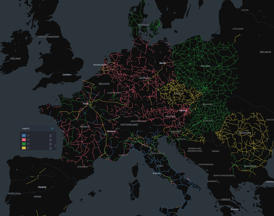
@wnd aside from the missing data, poland, hungary and romania all look too perfect. is romania really truly entirely GC gauge?

also, it looks like the mapping i want of national gauges -> international ones only exists in a $500 EN standard - EN 15273-2 - if anyone happens to have a copy on their desk :)

@HaTetsu @jon

@bovine3dom I would be able to sort this for GB gauges. European ones less so.

@HaTetsu @jon

@wnd for the UK i had a rummage around the rail data marketplace but i couldn't see an obvious dump of XML about the infrastructure, the track model seemed to more or less only tell you where they were?

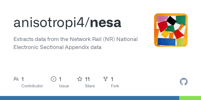
@bovine3dom the GB gauging is buried in a bunch of PDF files in the National Electronic Sectional Appendix (NESA). I scraped these here https://github.com/anisotropi4/nesa

Noting this isn't mapped to a geography but could then mapped using the track and waymarks from the track model https://raildata.org.uk/dataProduct/P-9b4e960e-8bb6-438b-9722-34ae5768a48f/overview

GitHub - anisotropi4/nesa: Extracts data from the Network Rail (NR) National Electronic Sectional Appendix data

Extracts data from the Network Rail (NR) National Electronic Sectional Appendix data - anisotropi4/nesa

GitHub
@bovine3dom (I should probably refresh this as it's been a while...)
@wnd thanks, but i was expecting to see W2 W7 etc, i thought those were the British classifications of loading gauge?
@bovine3dom @wnd @HaTetsu it’d not surprise me in Romania and Poland had indeed sorted this, yes. They’ve had double deck trains a long time in Romania.
@bovine3dom I would love to recreate this map with my students! Is it possible to provide the code via github? I assume it‘s in #julialang? -> which would be great!!

@kaat0 that would be awesome! but as i said there's some deeply weird stuff going on so there are definitely bugs to find :)

all the code is here https://github.com/bovine3dom/route_tchooseur

the "full" map you replied to uses a SPARQL query and DuckDB to make a parquet that i dumped in Kepler and then fiddled with the legend

the smaller map further up the thread is from the wrangler/ folder on that repo and parses the XML itself using Julia, which then gets shoved in Kepler for vis

1/2

@kaat0 i was intending to go back to the Julia method after lunch to see if it solved stuff like the dirittessima apparently missing from the SPARQL results

---

you wouldn't happen to have access to EN 15273-2 would you?

what i would really like is some mapping of train loading gauge -> compatible loading gauges of tracks and vice versa

i can sort of hack together national gauge -> compatible international gauges but it would be more satisfying to have national gauge -> national gauge

2/2

@bovine3dom i can have look for EN 15273-2! It might take a while…