Do you know cartes.app? It's a solid project that provides an interactive map of France, with a special focus on public transport.
In their blog, they document and explain why they develop each new feature.
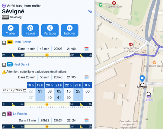
The last one 👇 was about the integration of each bus, tramway and subway line, in every city, thanks to obligation for operators to publish their schedules in GTFS on the national open data platform. Next modalities: train, intercity buses, ferryboats.