
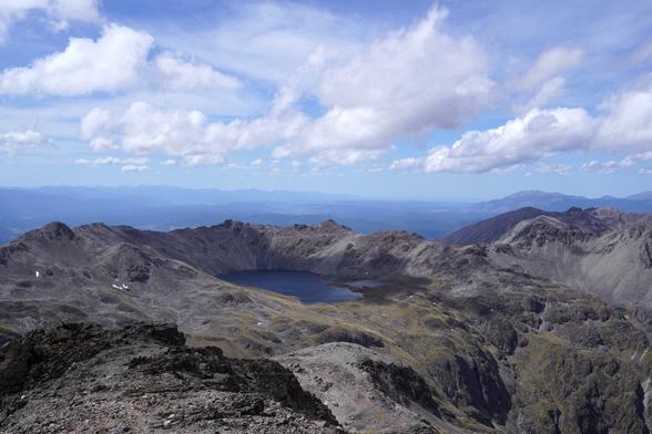
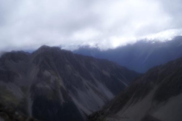
A windy day, but with excellent visibility, on Angelus Peak, this past Sunday. #NelsonLakes
That was the first time I climbed it on this trip, but not the last! #Aotearoa
A windy day, but with excellent visibility, on Angelus Peak, this past Sunday. #NelsonLakes
That was the first time I climbed it on this trip, but not the last! #Aotearoa
It turns out that my phone dropped out of the front pocket of my Aarn pack, I discovered a few minutes later.
There's no way I was going to be able to find it in this terrain, and I had no phone, because my spouse wasn't up for the 4 hour round trip to the summit after 5.5 hours to the hut. The track is relatively well marked but it is also easy to go off track, and the pockets were hanging a bit low, so away my phone went. Oops.
Spectacular terrain, though.
But I had noticed that I was on network, so I should be able to find the phone, I thought. The next day, I went for a walk, leaving at 5:25am. I was hoping to quickly find the phone and then walk back out to the Robert Ridge carpark.
Nope!
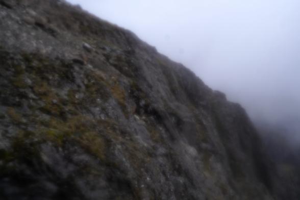
Visibility was much worse, though GPS-aided navigation was possible.
In case you were wondering: if you remember your Google password (which I do), you can use what is now called the Find Hub to find your phone. It'll let you enter e.g. your lock screen code as a secondary auth.
Unfortunately, the map that Find Hub displays is completely useless in the wilderness (it's the Google Maps map).
Fortunately, if you are temporarily off network, you get an error message which has a URL string with the GPS coordinates that you're finding. So I wrote down the coordinates. Having paper and pen was a critical win here. Otherwise I would have had to memorize the digits to type them into some other app.
It would be terrible to have the wrong coordinates, wouldn't it?
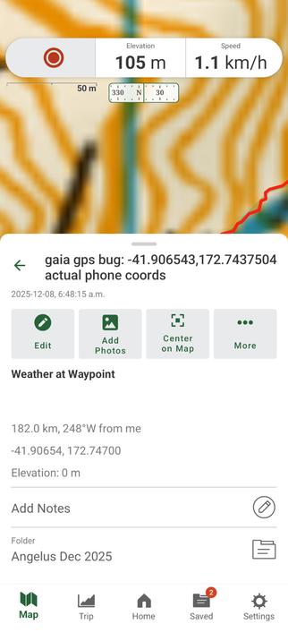
I entered the coordinates on the previous toot into Gaia GPS as a location.
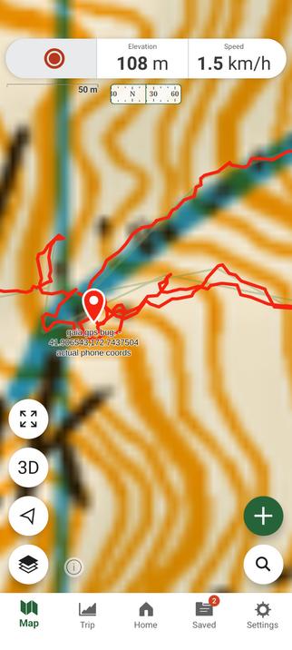
Let's zoom in on this track. You can see where I was looking for my phone, right? No phone found.
Strangely enough, the terrain to the indicated location was unfamiliar, and I had to cross snow to get there.
This location is 200m from the summit, which seems close, but really not close in this terrain. And Gaia was telling me I was like 1m from the alleged phone location.
I eventually gave up (after way too long navigating to this spot and way too long looking---like 2-3 hours!) and looked closely at the coordinates again.
Maybe I'll go climbing now and continue this tomorrow.
Can you see the discrepancy?
Oh, yeah, I had to cross snow to get to these coordinates. I did not remember any snow the previous day! Must have been an east facing slope.

But let me be super clear about this.
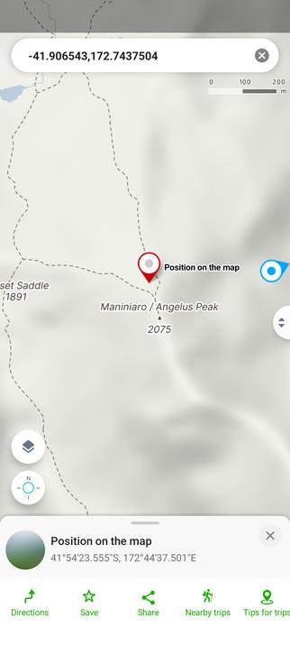
PUBLIC SERVICE ANNOUNCEMENT: if you enter decimal degrees coordinates into Gaia GPS and you enter "too many" decimal digits for its liking, it will mark a spot that is *not* the spot that you intended. #GaiaGPS
OK, where were we? Right. Not where the phone was, apparently.
I plugged the coordinates into the Mapy app and *it* told me a different story, which was far more reasonable: not 200m from the summit but rather only about 20m off from the (sort of indistinct) track. That makes a lot more sense.
Now I needed to get back to Angelus Hut. I didn't really feel like backtracking back up to the summit. It was still just 9am, fortunately, and sunset is at 8:30pm.
At this point, visibility was good, but occasionally it would rain on me. There were 20mm of rain forecast but I don't think it ever got to that much.
Surely I could descend some other way and maybe even wrap back over to the original track. (That was not at all the case, as it turns out, and if I had looked at the topo more closely, I would have figured it out).
@jlin well, I certainly didn't have my crampons or even yaktrax with me, but the snow was soft, pretty low angle, and I mostly avoided it.
Though when I was getting to the wrong point, I did follow the snow edge once: it was the easiest way. Not keen on reversing that back up to the summit, though maybe it would have been faster.