🌍 πŸ›°οΈ 🌱 πŸŒ½πŸ‘¨πŸΏβ€πŸŒΎπŸ›–πŸ’»βš™οΈ
Preprint on national-scale satellite-based crop field delineation in smallholder landscapes is out:
https://doi.org/10.48550/arXiv.2507.10499
🌍 πŸ›°οΈ 🌱 πŸŒ½πŸ‘¨πŸΏβ€πŸŒΎπŸ›–πŸ’»βš™οΈ
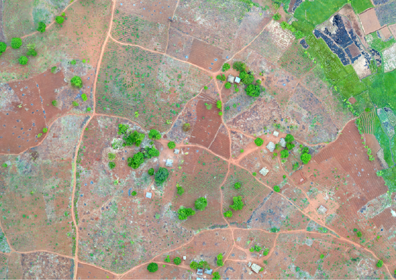
Despite free access to petabytes of satellite data, cloud computing platforms, and a wealth of high-performing computer vision models, satellite-based field delineation simply doesnΒ΄t work in landscapes dominated by smallholders (fragmented, heterogeneous, and dynamic)!
Smallholder-dominated landscapes are entirely different from the mechanized and consolidated landscapes (which are oftentimes considered for benchmarking AI models).
The literature on field delineation in smallholder systems remains relatively scarce and progress is slow overall (although cudos to the colleagues working on it). Therefore we donΒ΄t have field delineations at policy-relevant scales (e.g. national) where they are most needed.
The reason behind it is oftentimes constrained access to satellite imagery at very high spatial resolution needed in these systems (also see https://doi.org/10.1073/pnas.2410246122).
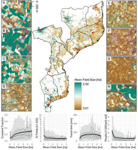
Our team had the opportunity to access SPOT6/7 data (1.5 m resolution) for Mozambique! We produced ~21 million individual field delineations for 2023, which allow unique insights into the spatial distribution of agriculture, field size and the linkages between agriculture and forest cover change!

Joint effort by Pauline Hammer, Leon-Friedrich Thomas, SΓ‘ Nogueira Lisboa, Natasha Ribeiro, Almeida Sitoe, Patrick Hostert & @pmeyfroidt

Thanks to Descartes Labs and ESA for providing access to SPOT6/7 data, and the F.R.S.-FNRS for funding the research!