Yes, this is an actual #FridayQuiz!
Can you provide the exact #geolocation?
🗣️ Reply to all to collaborate
✉️ Reply just to me with an answer
📄 Back up your answer with proof
#osint #quiztime
Yes, this is an actual #FridayQuiz!
Can you provide the exact #geolocation?
🗣️ Reply to all to collaborate
✉️ Reply just to me with an answer
📄 Back up your answer with proof
#osint #quiztime
If you need help, the quiztime crew is around here somewhere ... in parts.
Feel free to reach out to e.g. to @larswienand @sector035 @juliabayer @mahrko @twone2 @dondude

@fiete
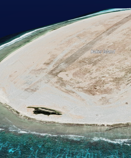
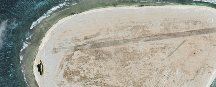
Somehow Google Lens takes the fun out of it 🙁 Based on the image search GL pointed out what felt like "everything in the Pacific that ever had an air strip". Visual identification showed that it can't be Tromelin Island, Tern Island, or Fiery Cross Reef. Baker Island was a match, although your image is south up. Interestingly the blob I mistook for a sign or building is actually a small body of water.
0°11.6229'N 176°28.3947'W