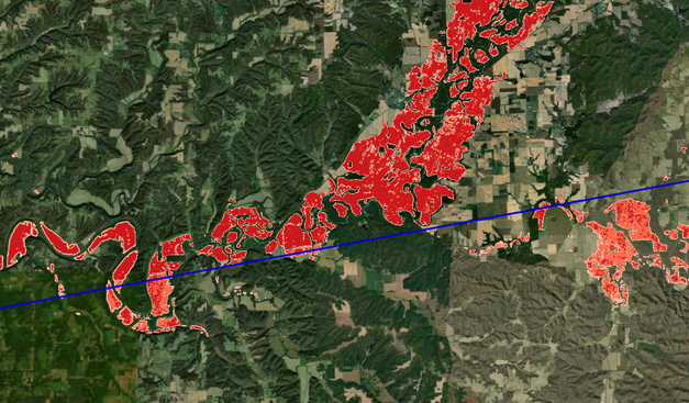
Significant, generational and historic #flooding across the Ohio River Valley following multiple days of heavy rainfall and severe storms. You can see the extent of the flooding in the Sentinel-1 #SAR derived flood mapping I made in support of operations here. I have masked out normal water detection from previous Sentinel-1 images so I'm only highlighting the floods. Sentinel-1 Acquisition Relative Orbit 121 on 6 Apr 2025 @ 23Z https://www.nohrsc.noaa.gov/special/leaflet/2025/sar_fim_20250406/index.html?x=-9541745.41895&y=4663230.60059&z=8.90728&r=0&l=1111111