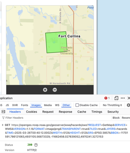
I don't know what this means, but a couple days ago my favorite MapClick.php weather app was using a map served by Esri. Now the tiles are coming from a https://opengeo.ncep.noaa.gov/geoserver/wwa/hazards/ows WMS. We've gone back in time to 2010 #opengeo #openlayers #nws

https://forecast.weather.gov/MapClick.php?lon=-105.096&lat=40.575

Esri tiles are back on MapClick.php, here at least.
Maybe they'll come and go, depending on the whims of some Gov-wrecking twenty-something. Who knows?
@sgillies I recently applied for a position asking Arc SDE 🤷‍♂️ (every time I am applying for GIS stuff with ESRI I am dying a bit inside ..)
@defuneste when I was at Mapbox, I took the NWS's choice of Esri for this personally. It looks like that contract got terminated and they're falling back onto an internal map solution?