We originally had a different topic planned for this week's #geoweirdness thread, but the global discussion has turned to Greenland 🇬🇱, so let's go with it.
Join us as we consider the geographic oddities of the world's northernmost territory.
1/
We originally had a different topic planned for this week's #geoweirdness thread, but the global discussion has turned to Greenland 🇬🇱, so let's go with it.
Join us as we consider the geographic oddities of the world's northernmost territory.
1/
2/ As we covered in our #geoweirdness thread about Denmark 🇩🇰,
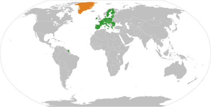
Greenland 🇬🇱 is an autonomous territory of the Kingdom of Denmark.
It has a population of only 50,000
The local government is responsible for local matters, while Denmark is
responsible for foreign policy and defence. The currency is the Danish Kroner.
3/ Denmark 🇩🇰 is part of the European Union 🇪🇺, but Greenland 🇬🇱 is not, having left the European Economic Community (the EU's predecessor) in 1985. Nevertheless, because they are citizens of the Danish Realm, Greenlandic citizens have EU citizenship.
https://en.wikipedia.org/wiki/Greenland_and_the_European_Union
As with most of the 32 "special territories of members of the European Economic Area", it's complicated.
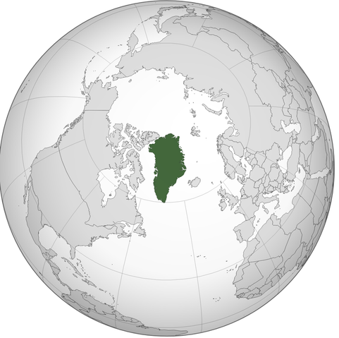
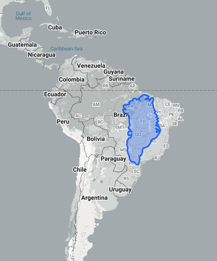
4/ Greenland 🇬🇱 is big, but probably not as big as you think.
Most map projections, including the widely used Mercator projection, distort the size of land near the poles. As a result Greenland looks much bigger than it actually is.
A great tool for visually comparing the true size of countries is ...
thetruesize.com
As this Dymaxion projection shows Greenland is "only" the 11th largest country.
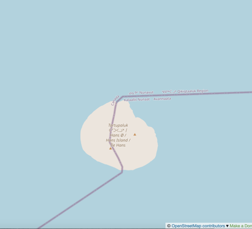
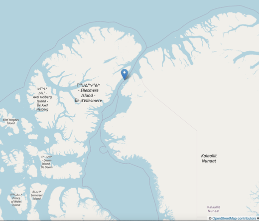
5/ In 2022 came the exciting geographic news of the new Canada 🇨🇦 / Greenland 🇬🇱 land border, when it was agreed to divide remote, uninhabited Hans Island.
This marked the end of the long-running and delightful "Whiskey War" in which the two sides left bottles of alcohol 🍾 for each other while taking down the other side's flag.
https://en.wikipedia.org/wiki/Whisky_War
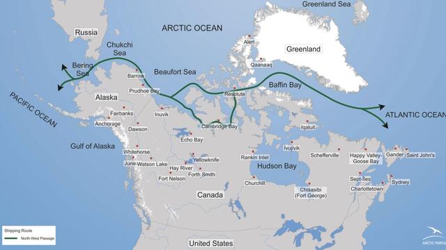
6/ While the dispute over Hans Island was not so serious, the Arctic is
increasingly becoming an area of strategic importance.
Climate change means melting ice which means the Northwest Passage, the sea route between Atlantic and Pacific, is now occasionally passable.
Greenland 🇬🇱 will sit on a key trade route.
https://en.wikipedia.org/wiki/Northwest_Passage#International_waters_dispute
Canada 🇨🇦 claims these to be internal waters, while most other countries say it is an international strait.
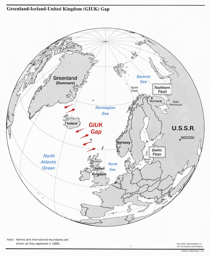
7/ Denmark 🇩🇰 is a founding member of NATO, and Greenland 🇬🇱 played a key role in the cold war, as part of the GIUK Gap (Greenland, Iceland 🇮🇸, United Kingdom 🇬🇧) a naval choke point, critical for the containment of the Soviet Union's naval forces during the cold war.
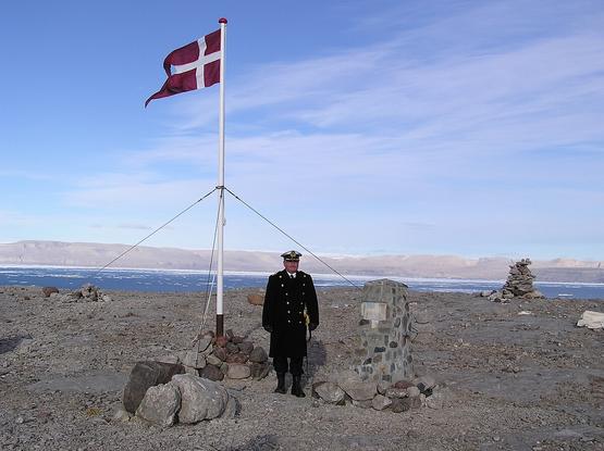
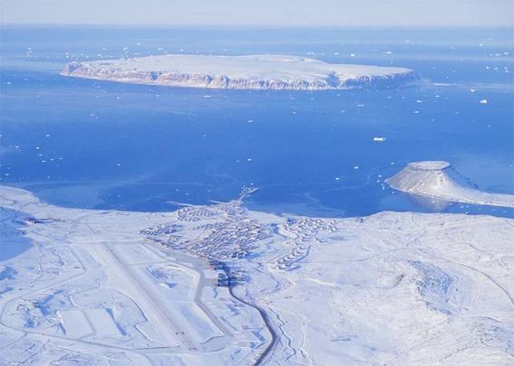
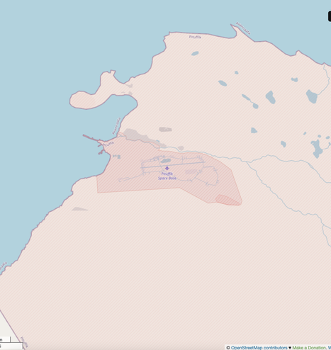
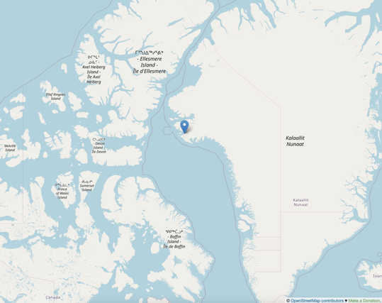
8/ It was during the Cold War that a US 🇺🇸 military facility, Thule Air Base, was established in the far north of Greenland 🇬🇱.
It is the site of the world's northernmost deep water port 1,210 km north of the Arctic Circle, and a territorial concession granted to the United States in perpetuity. In 2020 it was transferred to the US Space Force and renamed Pituffik Space Base 🚀
https://en.wikipedia.org/wiki/Pituffik_Space_Base
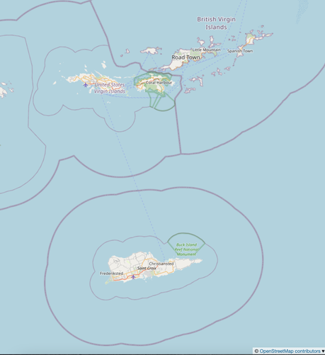
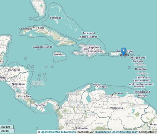
9/ There is some precedent for Denmark 🇩🇰 selling territory to the US 🇺🇸
In 1916 Denmark sold "the Danish West Indies" to the US, today they are known as the US Virgin Islands 🇻🇮
https://en.wikipedia.org/wiki/Treaty_of_the_Danish_West_Indies
As part of the deal, the US gave up any claims to Greenland 🇬🇱
10/ We hope you enjoyed our look at 🇬🇱 Greenlandic #geoweirdness
What did we miss?
You may also enjoy our threads about
🇩🇰 Denmark https://en.osm.town/@opencage/110165216804473987
or
🇨🇦 Canada https://en.osm.town/@opencage/109970277198086308
We have many more threads about specific countries, border disputes, geocoding, etc listed on our blog. Enjoy and thanks for sharing.

@opencage I see you have a blog post about enclaves, but have you done a post about pene-enclaves?
(Parts of a country only accessible via another country)
Scotland has a village only reachable from England, likewise Norway and Sweden 🙂 I think Northern Ireland and Eire too.
@stevefaeembra @opencage Sharing my fave - Minnesota’s Angle.
@brianrepko @stevefaeembra yes! Covered in our thread about the 50 US states:

Attached: 2 images 24/ Minnesota, MN Minnesota’s "Northwest Angle" is a pene-exclave—a small part of the state accessible by land only through Canada 🇨🇦 This unique feature resulted from 18th-century map errors during treaty negotiations. It’s the only part of the US aside Alaska which is above the 49th parallel https://en.wikipedia.org/wiki/Northwest_Angle https://www.openstreetmap.org/#map=10/49.1049/-94.9294 #geoweirdness