Interested in using computer vision (AI/ML) to help understand, manage, and conserve nature? We looking for someone to join our team working on models, software, and community outreach for our projects using airborne imagery to monitor and understand ecosystems at scales.
We do things like:
Identify and classify 100+ million trees to species using RGB, Hyperspectral, & LIDAR data: https://doi.org/10.1371/journal.pbio.3002700
Develop near real-time monitoring systems for birds in actively management ecosystems undergoing major restoration (the Everglades): https://doi.org/10.1002/rse2.421
Development software for detecting individual organisms in airborne imagery: https://github.com/weecology/DeepForest
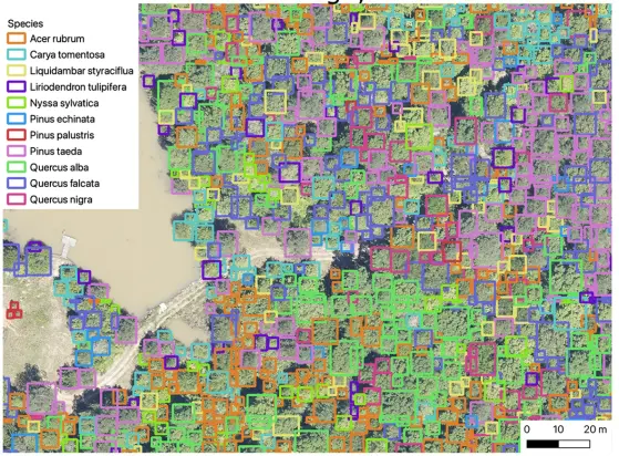
Individual canopy tree species maps for the National Ecological Observatory Network
Detailed maps of tree species can be used for forest analysis, biogeographic research and ecosystem monitoring. This study provides individual tree species maps for 24 sites in the United States National Ecological Observatory Network (NEON), covering 80 tree species and 100 million individuals.
Build web viz tools to support the use of our datasets: https://visualize.idtrees.org & https:/everwatch.weecology.org
Build open benchmarks: https://milliontrees.idtrees.org/en/latest/
If this sounds like your sort of thing check out the ad and let me know if you have any questions.
