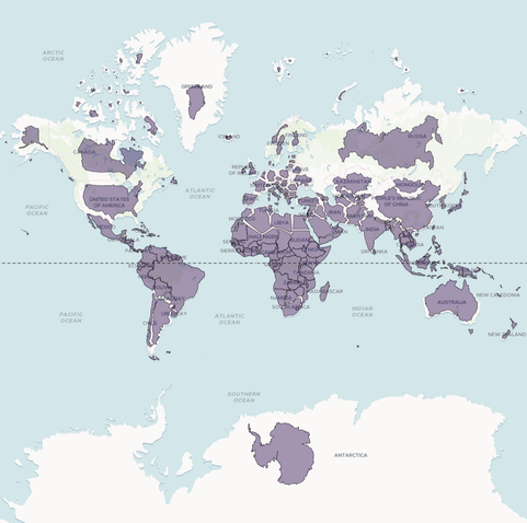
As good a day as any to remind myself that the way most of us has been taught the size of countries is misleading as hell.
@osma Mercator projection has its uses (largely if you are the navigator of a 17-century ship in the middle of the ocean), but the moment you center it on a different point you see how much it distorts everything.
@j_bertolotti @osma that's excellent

@j_bertolotti @osma some time ago ... I tried similar with explicit 3D, basically as I figured out how for different families ... try the interactive plots

https://mdsumner.github.io/2016/01/26/Three_Projections.html

I think your approach is a lot better and I'm going to steal it ;)

Illustrating Three Map Projections

@mdsumner If I may give a suggestion from the visualization point of view: the only real problem your images have is that they are a bit cluttered.Apart from that (and maybe the colour choice) they are great!
@j_bertolotti thanks yeah I was on the edge of my ability to get anything, it's inspiring seeing your really nice anim 🙏
@mdsumner You are a step away from a seriously good one, don't get discouraged 😃

@j_bertolotti is yours done in python ??

funnily enough I was experimenting again with orthographic plots today!

@mdsumner Mathematica (only language I can use)