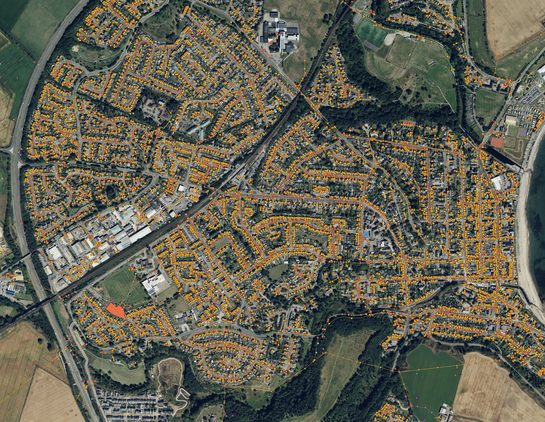
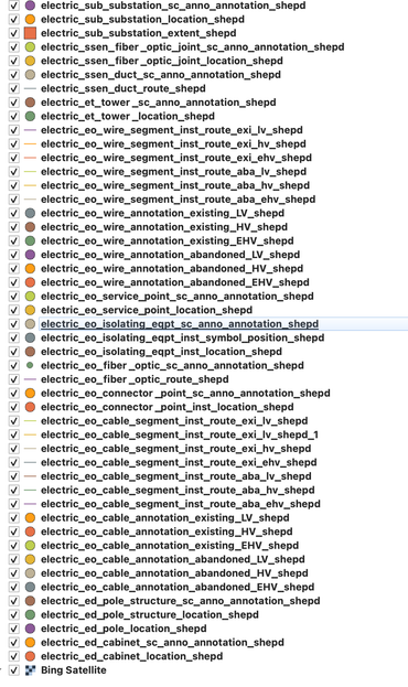
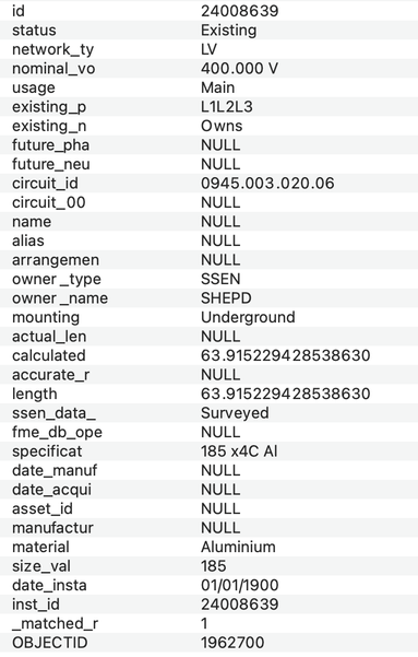
Winner of today's award for going beyond the call of duty in geodata publication is Scottish & Southern Electricity Networks. When asked to provide open data on their power network, they have simply provided the entire unredacted contents of their GIS.
@russss Is this on their open data portal or a FOI request or something else? Is there a link? I'm interested because another DNO has started putting their "open" data (nowhere near at the level of that) behind a registration wall.

@slowe it's free to download here, without registration:

https://data.ssen.co.uk/@ssen-distribution/distribution_line_substation

A number of them now require registration but it's all still CC-licensed once you're registered...

Distribution GIS Network Line and Shapefile Data - Data Asset - SSEN Distribution Data Portal

Shape file data containing our geographical position and attribution of the electricity network covering the SEPD and SHEPD DNO areas. A link is also provided for the Electric Office Web Portal for Independent Connections Providers (ICPs) to to view, query and print map based GIS Data, showing the location and associated data for circuits, cables and overhead lines across the Distribution Network at all voltage levels from EHV -> LV to assist in the planning of connections. Object information is drawn from EO to show selected asset details such as operating voltages. _These maps cannot be relied upon as they are indicative only and while we make every effort as to their accuracy, the position of any cables may have changed. In addition there may be private cables which are not shown on the plan. Before carrying out work of any kind within vicinity of any of the cables, you must carry out a search on Linesearch https://lsbud.co.uk/_

@russss That is amazing. I'm slightly stunned that they've published all that and that they can do it under CC-BY.