What are you mapping now?
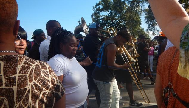
@openstreetmap I mapped parts of a "Second Line" parade in #NewOrleans this past Sunday with Viking, QGIS and, um, Avenza. Base layer: OpenStreetMap.

@openstreetmap We were richly rewarded for the effort (note the blue rope separating the Second Line musicians and performers from the spectators).
@openstreetmap This is what I started with, in #Viking, before loading into #QGis
I rushed a bit, as the "route sheet" was not published until a day or so before the Women of Class Second Line Parade. Thanks, WWOZ (FM) for the directions - https://www.wwoz.org/events/940481
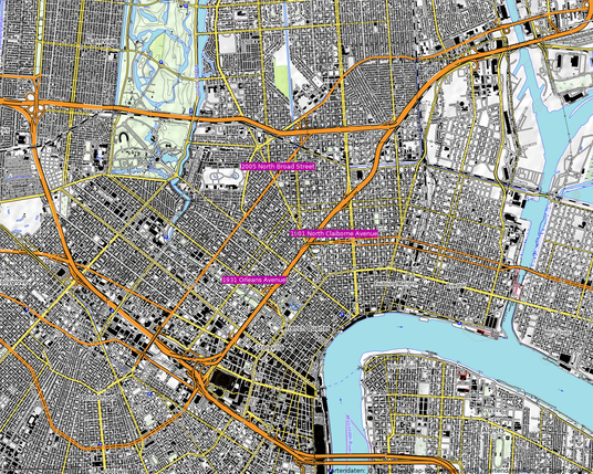
Women of Class Second Line Parade
Women of Class [Photo by Ryan Hodgson-Rigsbee] START 2005 N. Broad at J's Place. LEFT turn on St. Bernard Ave. Up St. Bernard to Galvez St. LEFT turn on Galvez St. to Touro St. RIGHT turn on Touro St. to N. Claiborne. RIGHT turn on N. Claiborne. STOP 1901 N. Claiborne at Da Jumpoff. N. Claiborne to St. Bernard. LEFT turn on St. Bernard to N. Robertson. RIGHT turn on N. Robertson to 1901