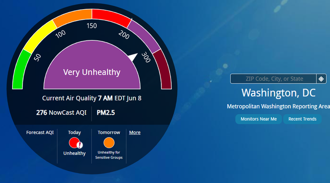
Put in your zip code and AirNow.gov tells you what the air is like in your area.

Please reblog

https://www.airnow.gov

AirNow.gov

AirNow is your one-stop source for air quality data. Our recently redesigned site highlights air quality in your local area first, while still providing air quality information at state, national, and world views.

@u0421793 @WillRobinson
Yeah, it's a .gov so it would't show directly outside of the home country's borders a few short years ago. That it's showing data in Canada & Mexico may indicate a realization that climate change doesn't stop at borders!

@deirdrebeth @u0421793 @WillRobinson Try https://fire.airnow.gov. It’s a newer tool that the EPA built that surfaces data for all of North America, over a map. There are official monitors in both Canada and Mexico, and home monitors included in the US, for more data.

We Californians have been using this heavily since it came out in 2019 or so.

AirNow Fire and Smoke Map

This map shows fine particle pollution (PM2.5) from wildfires and other sources. It provides a public resource of information to best prepare and manage wildfire season. Developed in a joint partnership between the EPA and USFS.