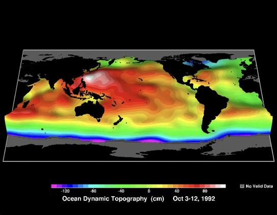
Even if you took away the waves, the ocean surface would not be flat.  That’s partly because Earth’s gravity varies across the surface, pulling water around and creating huge lumps and holes up to 100m high/deep. But then temperature, salinity, atmospheric pressure and currents add extra dynamic bumps on top of this of a few tens of cm.  Tracking these lets us measure ocean currents from satellites, which is an astonishing feat.
 
#ocean #satellites #OceanPhysics
@helenczerski Should 100m high/deep be 100cm as the key indicates?
@allanwolfe @helenczerski I'd suggest 100 meters is relevant.
@allanwolfe The picture shows dynamic topography, which is as the key indicates - tens of cm. But the geoid variations - the bigger, fixed hills and troughs - are indeed of the order of tens of metres. The dips just south of India is around 70 metres deep.

@helenczerski @allanwolfe

Do you have an image that is more recent than 1992 ?

@helenczerski Thanks for the lucid explanation. I appreciate and enjoy your toots.