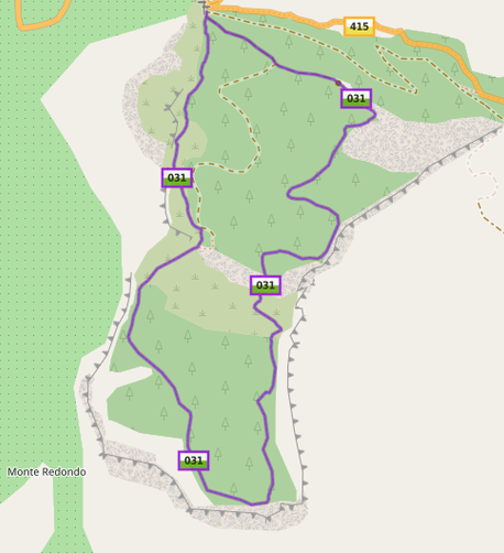
One of the most satisfying aspects of contributing to OpenStreetMap for me is walking a previously unmapped hiking trail, adding it to OSM, and seeing it appear on waymarkedtrails.org (and later in various hiking-oriented Android apps).

Recently I had the chance to survey a short waymarked trail that was completely unmapped (both the physical path and the waymarking). Here are the "before and after" screenshots from hiking.waymarkedtrails.org.

#OpenStreetMap #hiking

@alan this is going to be super helpful. What app do you use? Any iOS app recommendation for #OpenStreetMap ?

@xinbenlv Recently I have been using Mapy (mapy.cz). thanks to a recommendation here on Mastodon from @gustav. I use it on Android but there is also an iOS app, and you can also view maps through a desktop browser (choose "Outdoor" under "Change Map" to highlight hiking trails).

#OpenStreetMap #hiking #mapycz

@xinbenlv I also like the OruxMaps app with OpenAndroMaps, but that is Android-only. It has a very rich feature set. I use it especially when I am surveying a trail in detail, to record both photo waypoints and the trail itself - Oruxmaps zips them all up in a handy kmz file that I can later process on the desktop for mapping.
@xinbenlv In the city and suburbs I also use Organicmaps (again both Android and iOS). Last time I checked though it didn't highlight waymarked hiking trails, so I don't use it so much in the countryside.