
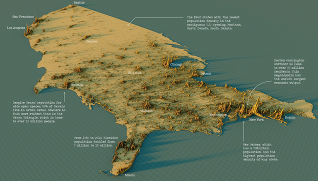
Where Americans live, in 3D
Source: https://www.visualcapitalist.com/cp/3d-mapping-the-worlds-largest-population-densities/
Source: https://www.visualcapitalist.com/cp/3d-mapping-the-worlds-largest-population-densities/
Why do visualisations always cut off the countries to which the USA is attached? (Never mind the non-continental bits of the states, and even then they usually only show Alaska and Hawaii, not the other Territories.) It contributes to geographic illiteracy, IMHO.
