3D Map: The World’s Largest Population Density Centers

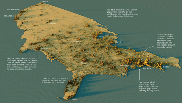
What does population density look like on a global scale? These detailed 3D renders illustrate our biggest urban areas and highlight population trends.

Visual Capitalist
@conradhackett for us in the US it is so powerful to see visualizations like this and then overlay over congressional and senatorial districts.