Lastly, this is a fine view of the Orientale area, with the limb at left crossing the South Pole-Aitken basin and giving a nice topographic profile of the basin. #moon #zond
These are views over Mare Orientale looking east with the peaks of the Cordilleras on the horizon. I have done no cosmetic cleanup to these images. #moon The Earth has a big reseau cross over it. #Zond
Some Zond 8 images now. This is a very reduced version of the high resolution image swath.
#moon #zond
This map shows the Zond 8 image strip coverage, the Zond 6 and 7 image areas, and the Apollo image coverage (omitting only Apollo 13 and the global views taken during departure). Soviet planetary geologists made a nice set of maps of the Zond 8 area with relief drawings and a geological interpretation. Until LRO these were the best images of that region. A limb profile gave another look at topography in the South Pole-Aitken basin (see Zond 6 notes). #moon #zond
Kira Shingareva came to Houston one year with CD-ROMs of scanned Zond 8 images. A set went to LPI, I got a set, there may have been others (I was her driver and guide on that trip). The scans revealed something interesting: the images were good quality but had a few scratches. They had not been protected as well as Apollo negatives were (after being developed they were copied and the originals archived for decades with all work done on copies). Only recently were they scanned again.
#moon #zond

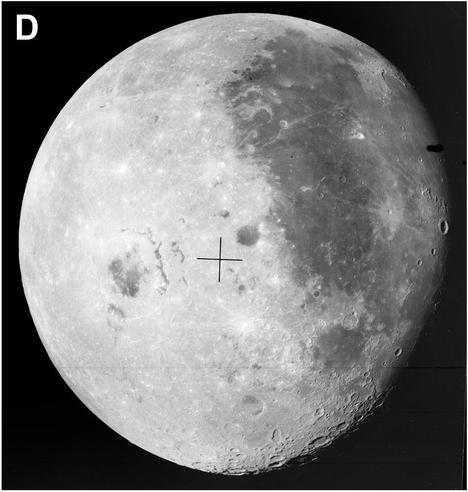
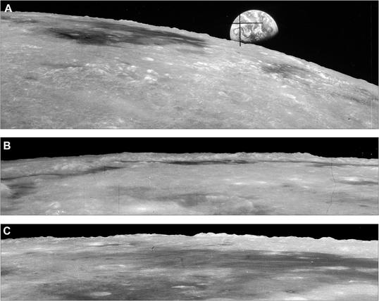
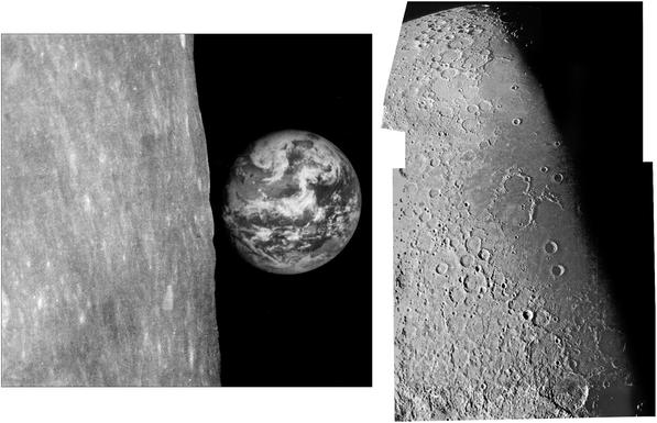
Luna 16 was followed by Zond 8, the last test flight of this type of spacecraft. It followed the pattern of a flight around the Moon and back, not going into orbit (like Artemis 2, not Apollo 8 and 10). NSSDCA provides a few details:
https://nssdc.gsfc.nasa.gov/nmc/spacecraft/display.action?id=1970-088A

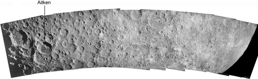
The photography was much better on this mission with large images taken of a full disk and a lower altitude strip of the farside highlands. Don Mitchell has a good selection:

http://mentallandscape.com/C_CatalogMoon.htm (halfway down). #moon #zond

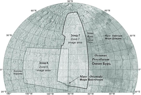
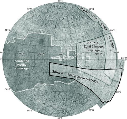
This map shows the extent of Zond 7 image coverage, extending a bit further south than my mosaic. This is from an index I scanned in Moscow.

NOTE: in my original posts for Zond 7 I accidentally called it Zond 6, which we have already covered. Posts have been corrected. #moon #Zond

Zond 7 was the next test flight of the spacecraft intended to fly people to the Moon. It was a very successful flight and the only one which would have landed a crew safely, if it had a crew. But it didn't - it flew some turtles and a radiation sensor package, and it took pictures of Earth and the Moon. Here are two images from the mission, Earth over the limb (Earth is setting, not rising) and a mosaic of image running down the terminator showing Oceanus Procellarum at right. #moon #Zond
Next up after Zond 6 was Luna 15, a sample return lander which flew at the same time as Apollo 11. This was a last-ditch effort to bring a sample back before Apollo, allowing the Soviet Union some small bragging rights. If Luna 15 had followed the flight profile of Luna 16 it might have returned lunar samples slightly ahead of Apollo 11, but it spent an extra day in lunar orbit and lost that chance. Then it crashed the day after Apollo 11 landed - but where? #moon #Zond
This map is based on a Zond 6 image index map I scanned at MIIGAiK. The region covered here was mostly seen by Lunar Orbiter obliquely near the terminator, and the Vavilov image shows some Zond 6 coverage was the best available at the time. The most significant science was from the full disk view. Careful measurement of the limb at lower left revealed a huge depressed area - the South Pole-Aitken basin (ref in ALT text). #moon #Zond