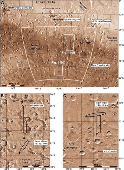
This map shows the ARES area of interest. Why here? The mission would fly a magnetometer over linear magnetic anomalies - see this map:
https://en.wikipedia.org/wiki/Crustal_magnetism#/media/File:Mars_Crustal_Magnetism_MGS.png
There would be some atmospheric observations too, but they could be done anywhere. The bottom maps are two suggested flight paths. The ellipses are deployment locations after atmospheric entry - deploy in mid-air, a rather frightening thought. The whole flight would only last a few hours, all in daylight.
#maps #mars #marsaircraft